Ayancık night lights from space
Night Light of Ayancık (Sinop) from space (Turkey) Src. Average luminocity for 10x10km area is 4.5317% and for 50x50km: 0.578%.
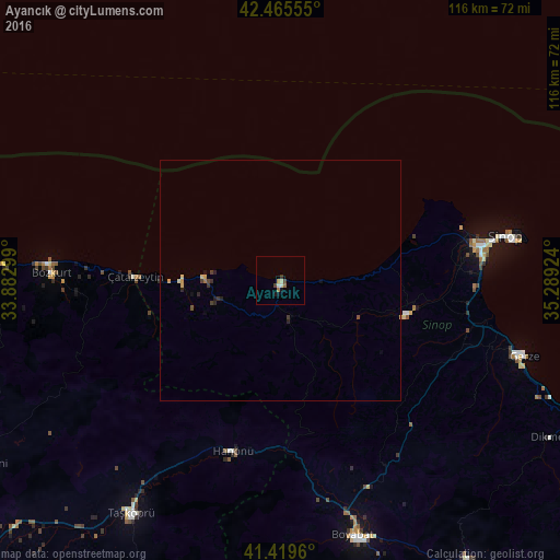
Analysis of Ayancık night lights 2016
Square area 10x10 km:
 0%
0%90-99
1.27%80-89
0.63%70-79
0.48%60-69
1.11%50-59
0.32%40-49
1.27%30-39
0.16%20-29
0.48%10-19
1.59%0-9
92.7%Square area 50x50 km:
0%90-99
0.05%80-89
0.1%70-79
0.13%60-69
0.08%50-59
0.04%40-49
0.13%30-39
0.14%20-29
0.2%10-19
0.15%0-9
98.98%Clear (daylight) street map image can be seen on geolist.org.
Map coordinates:
42° 27' 56" North, 33° 52' 58.8" East
41° 56' 41" North, 34° 35' 10" East
41° 25' 10.6" North, 35° 17' 21.3" East
Some cities around Ayancık sort by population:
• Sinop
48.5 km =30.1 mi,  79°
79°
• Boyabat
55 km =34.2 mi,  164°
164°
• Taşköprü
57.4 km =35.7 mi,  212°
212°
• Durağan
70.5 km =43.8 mi,  146°
146°
• Gerze
53.3 km =33.1 mi,  107°
107°
• İnebolu
68.3 km =42.4 mi,  272°
272°
• Türkeli
20.5 km =12.7 mi, 270°
• Bozkurt
47.6 km =29.6 mi, 271°
751516 (p: 11,779)
Sources (retrieved 2019-11-25):
» Earth at Night: Flat Maps 2012, 2016