Türkeli night lights from space
Night Light of Türkeli (Sinop) from space (Turkey) Src. Average luminocity for 10x10km area is 5.8111% and for 50x50km: 0.7616%.
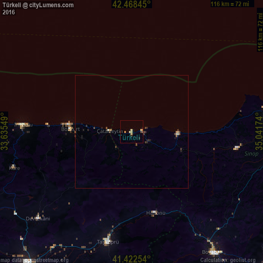
Analysis of Türkeli night lights 2016
Square area 10x10 km:
 0%
0%90-99
0%80-89
1.9%70-79
2.38%60-69
0.79%50-59
0%40-49
0.16%30-39
0.48%20-29
1.9%10-19
1.27%0-9
91.11%Square area 50x50 km:
0%90-99
0.08%80-89
0.1%70-79
0.15%60-69
0.12%50-59
0.04%40-49
0.19%30-39
0.2%20-29
0.29%10-19
0.25%0-9
98.58%Clear (daylight) street map image can be seen on geolist.org.
Map coordinates:
42° 28' 6.4" North, 33° 38' 7.8" East
41° 56' 51.5" North, 34° 20' 19" East
41° 25' 21.1" North, 35° 2' 30.3" East
Some cities around Türkeli sort by population:
• Sinop
68.7 km =42.7 mi,  82°
82°
• Boyabat
64 km =39.8 mi,  146°
146°
• Taşköprü
49.8 km =30.9 mi,  191°
191°
• Ayancık
20.5 km =12.7 mi,  90°
90°
• Gerze
73.2 km =45.5 mi,  102°
102°
• İnebolu
47.9 km =29.8 mi,  273°
273°
• Devrekani
56.4 km =35 mi,  227°
227°
• Bozkurt
27.1 km =16.8 mi, 272°
738614 (p: 8,287)
Sources (retrieved 2019-11-25):
» Earth at Night: Flat Maps 2012, 2016