Atabey night lights from space
Night Light of Atabey (Isparta) from space (Turkey) Src. Average luminocity for 10x10km area is 13.2549% and for 50x50km: 9.2681%.
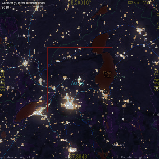
Analysis of Atabey night lights 2016
Square area 10x10 km:
 0%
0%90-99
3.9%80-89
1.95%70-79
2.6%60-69
0.65%50-59
0.65%40-49
1.3%30-39
0.97%20-29
2.6%10-19
4.22%0-9
81.17%Square area 50x50 km:
0.83%90-99
1.95%80-89
1.14%70-79
1.01%60-69
1.17%50-59
0.81%40-49
1.21%30-39
1.53%20-29
2.31%10-19
4.92%0-9
83.1%Clear (daylight) street map image can be seen on geolist.org.
Map coordinates:
38° 30' 11.4" North, 29° 56' 7.8" East
37° 57' 3" North, 30° 38' 19" East
37° 23' 39.5" North, 31° 20' 30.3" East
Some cities around Atabey sort by population:
• Isparta
22.1 km =13.7 mi,  200°
200°
• Burdur
39.9 km =24.8 mi,  229°
229°
• Eğirdir
20.4 km =12.7 mi,  114°
114°
• Senirkent
18.8 km =11.7 mi,  335°
335°
• Gönen
11.2 km =7 mi,  273°
273°
• Uluborlu
21.8 km =13.5 mi,  310°
310°
• Keçiborlu
29.5 km =18.3 mi, 268°
• Gelendost
38 km =23.6 mi,  60°
60°
323039 (p: 12,658)
Sources (retrieved 2019-11-25):
» Earth at Night: Flat Maps 2012, 2016