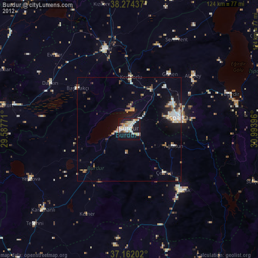
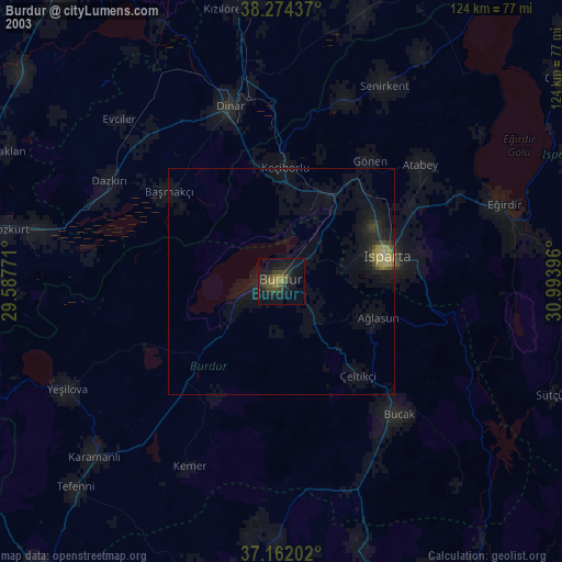
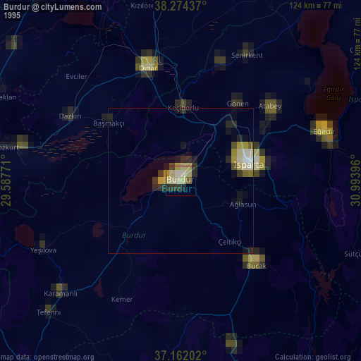
Burdur night lights from space
Night Light of Burdur from space (Turkey) Src. Average luminocity for 10x10km area is 52.6633% and for 50x50km: 10.7064%.
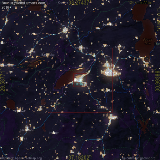
Analysis of Burdur night lights 2016
Square area 10x10 km:
 8.16%
8.16%90-99
13.95%80-89
9.18%70-79
8.16%60-69
4.76%50-59
1.87%40-49
5.44%30-39
5.78%20-29
25.34%10-19
17.35%0-9
0%Square area 50x50 km:
1.07%90-99
1.84%80-89
1.5%70-79
1.22%60-69
1.02%50-59
0.77%40-49
1.48%30-39
1.99%20-29
3.31%10-19
6.9%0-9
78.89%Clear (daylight) street map image can be seen on geolist.org.
Map coordinates:
38° 16' 27.7" North, 29° 35' 15.8" East
37° 43' 13" North, 30° 17' 27" East
37° 9' 43.3" North, 30° 59' 38.3" East
Some cities around Burdur sort by population:
• Isparta
23.5 km =14.6 mi,  77°
77°
• Dinar
39.9 km =24.8 mi,  343°
343°
• Bucak
39.5 km =24.5 mi,  137°
137°
• Gönen
32.6 km =20.3 mi,  36°
36°
• Atabey
39.9 km =24.8 mi,  49°
49°
• Uluborlu
42.2 km =26.2 mi,  19°
19°
• Keçiborlu
24.7 km =15.3 mi,  2°
2°
• Başmakçı
31.4 km =19.5 mi,  308°
308°
320392 (p: 66,158)
Sources (retrieved 2019-11-25):
» NASA, Earths city lights 1995
» NASA city lights 2003
» Earth at Night: Flat Maps 2012, 2016