Arnavutköy night lights from space
Night Light of Arnavutköy (Istanbul) from space (Turkey) Src. Average luminocity for 10x10km area is 46.4545% and for 50x50km: 38.058%.
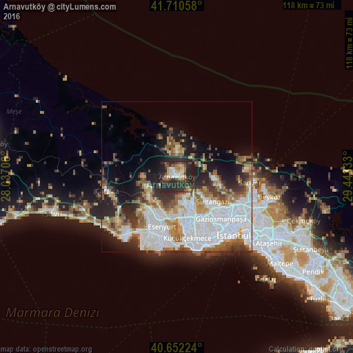
Analysis of Arnavutköy night lights 2016
Square area 10x10 km:
 4.06%
4.06%90-99
7.63%80-89
5.84%70-79
6.33%60-69
6.17%50-59
8.28%40-49
6.49%30-39
12.99%20-29
36.04%10-19
6.17%0-9
0%Square area 50x50 km:
13.78%90-99
7.2%80-89
2.53%70-79
3.48%60-69
4.95%50-59
4.99%40-49
3.27%30-39
4.16%20-29
7.87%10-19
9.21%0-9
38.55%Clear (daylight) street map image can be seen on geolist.org.
Map coordinates:
41° 42' 38.1" North, 28° 2' 13.5" East
41° 11' 0.8" North, 28° 44' 24.7" East
40° 39' 8.1" North, 29° 26' 36" East
Some cities around Arnavutköy sort by population:
• Bağcılar
18.8 km =11.7 mi,  148°
148°
• Esenler
19.3 km =12 mi,  143°
143°
• Sultangazi
13.7 km =8.5 mi,  128°
128°
• Esenyurt
18.2 km =11.3 mi,  196°
196°
• Başakşehir
11.3 km =7 mi, 152°
• Büyükçekmece
22.3 km =13.9 mi,  215°
215°
• Yakuplu
22.3 km =13.9 mi,  194°
194°
• Boyalık
12.7 km =7.9 mi,  314°
314°
751868 (p: 198,165)
Sources (retrieved 2019-11-25):
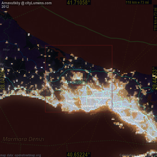
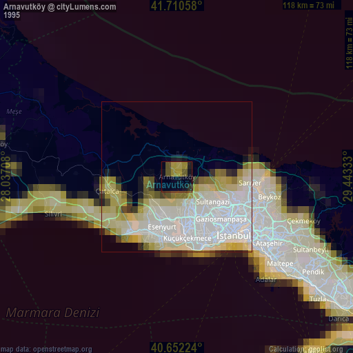
» NASA, Earths city lights 1995
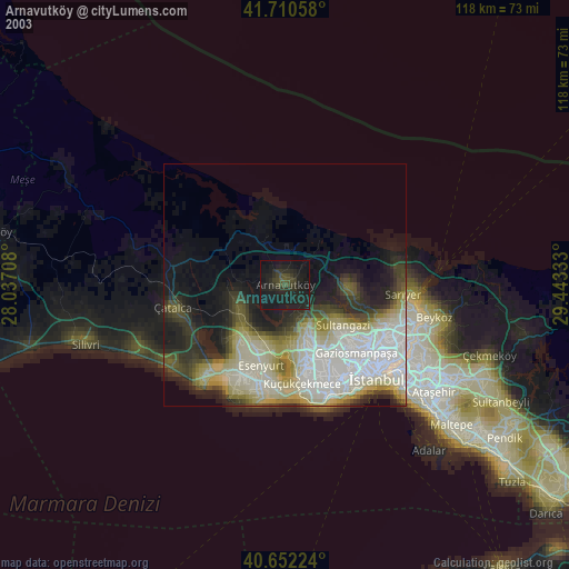
» NASA city lights 2003
» Earth at Night: Flat Maps 2012, 2016