Alaca night lights from space
Night Light of Alaca (Çorum) from space (Turkey) Src. Average luminocity for 10x10km area is 17.6737% and for 50x50km: 1.5299%.
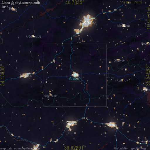

Analysis of Alaca night lights 2016
Square area 10x10 km:
 2.44%
2.44%90-99
4.06%80-89
2.76%70-79
1.79%60-69
0.97%50-59
1.79%40-49
0.97%30-39
1.79%20-29
2.27%10-19
7.63%0-9
73.54%Square area 50x50 km:
0.1%90-99
0.19%80-89
0.14%70-79
0.15%60-69
0.17%50-59
0.19%40-49
0.33%30-39
0.56%20-29
0.42%10-19
0.54%0-9
97.22%Clear (daylight) street map image can be seen on geolist.org.
Map coordinates:
40° 42' 12.6" North, 34° 8' 21.8" East
40° 10' 6" North, 34° 50' 33" East
39° 37' 44.1" North, 35° 32' 44.3" East
Some cities around Alaca sort by population:
• Çorum
43.3 km =26.9 mi,  12°
12°
• Yozgat
38.9 km =24.2 mi,  184°
184°
• Sorgun
49.4 km =30.7 mi,  143°
143°
• Sungurlu
39.8 km =24.7 mi,  269°
269°
• Çekerek
56.5 km =35.1 mi,  100°
100°
• Uğurludağ
45.3 km =28.1 mi,  313°
313°
• Aydıncık
38.1 km =23.7 mi, 96°
• Mecitözü
54.8 km =34.1 mi,  44°
44°
752278 (p: 27,019)
Sources (retrieved 2019-11-25):
» Earth at Night: Flat Maps 2012, 2016