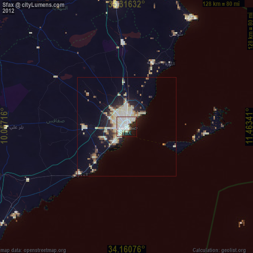
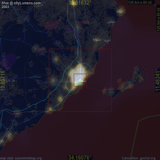
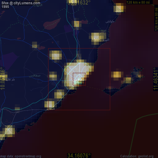
Sfax night lights from space
Night Light of Sfax (Şafāqis) from space (Tunisia) Src. Average luminocity for 10x10km area is 73.5348% and for 50x50km: 12.4014%.
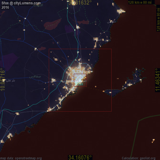
Analysis of Sfax night lights 2016
Square area 10x10 km:
 31.32%
90-99
20.51%80-89
7.88%70-79
4.03%60-69
8.42%50-59
1.28%40-49
2.56%30-39
5.49%20-29
10.07%10-19
6.78%0-9
1.65%Square area 50x50 km:
1.88%90-99
1.79%80-89
2.18%70-79
1.88%60-69
2.27%50-59
1.07%40-49
1.35%30-39
1.72%20-29
2.84%10-19
6.03%0-9
77%Clear (daylight) street map image can be seen on geolist.org.
Map coordinates:
35° 18' 58.8" North, 10° 3' 25.8" East
34° 44' 26" North, 10° 45' 37" East
34° 9' 38.7" North, 11° 27' 48.3" East
Some cities around Sfax sort by population:
• Gremda
2.4 km =1.5 mi,  63°
63°
• Ksour Essaf
78.3 km =48.7 mi,  15°
15°
• Chebba
64 km =39.8 mi,  30°
30°
• El Jem
62.3 km =38.7 mi,  356°
356°
• Djebeniana
35.4 km =22 mi, 22°
• Sidi Alouane
72.4 km =45 mi,  12°
12°
• Melloulèche
53.5 km =33.2 mi, 27°
• Chorbane
69.6 km =43.2 mi,  330°
330°
2467454 (p: 277,278)
Sources (retrieved 2019-11-25):
» NASA, Earths city lights 1995
» NASA city lights 2003
» Earth at Night: Flat Maps 2012, 2016