Mahdia night lights from space
Night Light of Mahdia (Al Mahdīyah) from space (Tunisia) Src. Average luminocity for 10x10km area is 30.4487% and for 50x50km: 8.1048%.
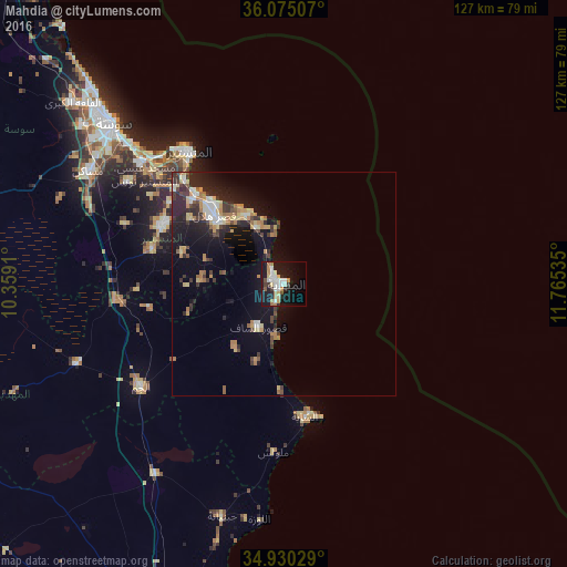
Analysis of Mahdia night lights 2016
Square area 10x10 km:
 6.04%
6.04%90-99
7.14%80-89
3.11%70-79
4.03%60-69
4.21%50-59
0.92%40-49
1.65%30-39
2.93%20-29
4.03%10-19
33.33%0-9
32.6%Square area 50x50 km:
0.86%90-99
0.9%80-89
1.15%70-79
0.99%60-69
1.4%50-59
0.56%40-49
1.01%30-39
1.43%20-29
2.85%10-19
7.06%0-9
81.76%Clear (daylight) street map image can be seen on geolist.org.
Map coordinates:
36° 4' 30.3" North, 10° 21' 32.8" East
35° 30' 17" North, 11° 3' 44" East
34° 55' 49" North, 11° 45' 55.3" East
Some cities around Mahdia sort by population:
• Zouila
0.5 km =0.3 mi,  197°
197°
• Ksar Hellal
22.2 km =13.8 mi,  315°
315°
• Ksour Essaf
11.4 km =7.1 mi,  212°
212°
• Bekalta
13.9 km =8.6 mi,  333°
333°
• Seïada
23.8 km =14.8 mi, 319°
• Beni Hassane
24 km =14.9 mi,  286°
286°
• Sidi Alouane
18.2 km =11.3 mi,  217°
217°
• Lemta
24.2 km =15 mi, 318°
2473572 (p: 45,977)
Sources (retrieved 2019-11-25):
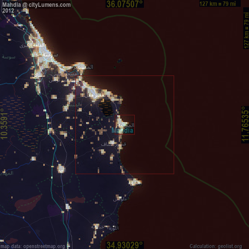
» Earth at Night: Flat Maps 2012, 2016