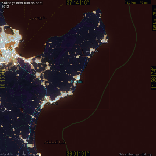
Korba night lights from space
Night Light of Korba (Nābul) from space (Tunisia) Src. Average luminocity for 10x10km area is 21.8132% and for 50x50km: 6.8053%.
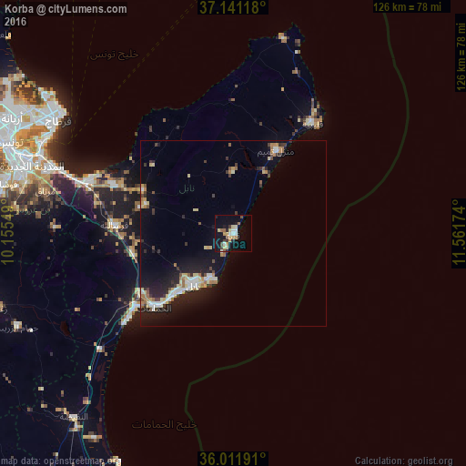
Analysis of Korba night lights 2016
Square area 10x10 km:
 2.01%
2.01%90-99
3.48%80-89
4.21%70-79
3.85%60-69
2.01%50-59
1.28%40-49
3.3%30-39
1.83%20-29
2.2%10-19
21.79%0-9
54.03%Square area 50x50 km:
0.74%90-99
1%80-89
1.13%70-79
0.7%60-69
0.86%50-59
0.5%40-49
0.56%30-39
1.12%20-29
1.65%10-19
6.36%0-9
85.37%Clear (daylight) street map image can be seen on geolist.org.
Map coordinates:
37° 8' 28.2" North, 10° 9' 19.8" East
36° 34' 43" North, 10° 51' 31" East
36° 0' 42.9" North, 11° 33' 42.3" East
Some cities around Korba sort by population:
• Douane
17.2 km =10.7 mi,  212°
212°
• Nabeul
17.4 km =10.8 mi,  218°
218°
• Dar Chabanne
15.6 km =9.7 mi, 217°
• Beni Khiar
14 km =8.7 mi, 209°
• Mennzel Bou Zelfa
27.1 km =16.8 mi,  295°
295°
• Beni Khalled
25.3 km =15.7 mi,  288°
288°
• El Maamoura
13.5 km =8.4 mi,  200°
200°
• Zaouiat Djedidi
26.4 km =16.4 mi, 285°
2467920 (p: 33,589)
Sources (retrieved 2019-11-25):
» Earth at Night: Flat Maps 2012, 2016