Wichian Buri night lights from space
Night Light of Wichian Buri (Phetchabun) from space (Thailand) Src. Average luminocity for 10x10km area is 13.7078% and for 50x50km: 2.7238%.
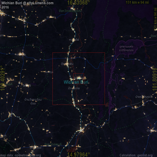
Analysis of Wichian Buri night lights 2016
Square area 10x10 km:
 0%
0%90-99
1.52%80-89
3.03%70-79
1.95%60-69
1.3%50-59
0.65%40-49
0.43%30-39
6.06%20-29
3.03%10-19
1.08%0-9
80.95%Square area 50x50 km:
0.02%90-99
0.21%80-89
0.66%70-79
0.35%60-69
0.26%50-59
0.32%40-49
0.51%30-39
0.65%20-29
0.82%10-19
0.19%0-9
96.02%Clear (daylight) street map image can be seen on geolist.org.
Map coordinates:
16° 20' 1.2" North, 100° 24' 10.5" East
15° 39' 28" North, 101° 6' 21.7" East
14° 58' 46.7" North, 101° 48' 33" East
Some cities around Wichian Buri sort by population:
• Phetchabun
84.8 km =52.7 mi,  3°
3°
• Nong Phai
37.3 km =23.2 mi,  352°
352°
• Chai Badan
51 km =31.7 mi,  176°
176°
• Chon Daen
64.7 km =40.2 mi,  335°
335°
• Thap Khlo
78 km =48.5 mi,  315°
315°
• Bamnet Narong
64.9 km =40.3 mi,  105°
105°
• Nong Bua
60.2 km =37.4 mi,  292°
292°
• Phai Sali
49.3 km =30.6 mi,  262°
262°
1605024 (p: 39,272)
Sources (retrieved 2019-11-25):
» Earth at Night: Flat Maps 2012, 2016