Bamnet Narong night lights from space
Night Light of Bamnet Narong (Chaiyaphum) from space (Thailand) Src. Average luminocity for 10x10km area is 4.8139% and for 50x50km: 2.0864%.
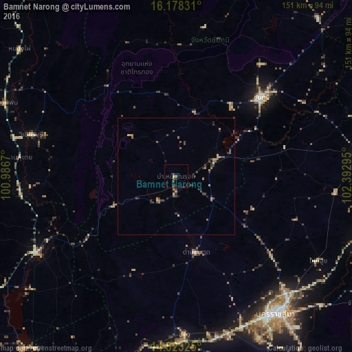
Analysis of Bamnet Narong night lights 2016
Square area 10x10 km:
 0%
0%90-99
0%80-89
0.87%70-79
0%60-69
0.22%50-59
1.95%40-49
1.95%30-39
1.08%20-29
1.3%10-19
2.6%0-9
90.04%Square area 50x50 km:
0%90-99
0.05%80-89
0.33%70-79
0.33%60-69
0.34%50-59
0.31%40-49
0.68%30-39
0.58%20-29
0.66%10-19
0.33%0-9
96.39%Clear (daylight) street map image can be seen on geolist.org.
Map coordinates:
16° 10' 41.9" North, 100° 59' 12.1" East
15° 30' 6.8" North, 101° 41' 23.4" East
14° 49' 23.7" North, 102° 23' 34.6" East
Some cities around Bamnet Narong sort by population:
• Chaiyaphum
49.9 km =31 mi,  46°
46°
• Wichian Buri
64.9 km =40.3 mi,  285°
285°
• Amphoe Sikhiu
67 km =41.6 mi,  178°
178°
• Chai Badan
68.5 km =42.6 mi,  240°
240°
• Dan Khun Thot
33.8 km =21 mi,  164°
164°
• Sung Noen
68.5 km =42.6 mi,  168°
168°
• Non Thai
53.2 km =33.1 mi,  129°
129°
• Kham Sakae Saeng
55.1 km =34.2 mi,  110°
110°
1620989 (p: 14,890)
Sources (retrieved 2019-11-25):
» Earth at Night: Flat Maps 2012, 2016