Rayong night lights from space
Night Light of Rayong from space (Thailand) Src. Average luminocity for 10x10km area is 78.6429% and for 50x50km: 29.0736%.
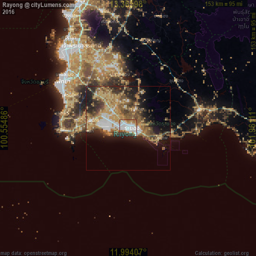
Analysis of Rayong night lights 2016
Square area 10x10 km:
 29.65%
90-99
25.54%80-89
4.11%70-79
8.01%60-69
9.31%50-59
3.46%40-49
4.11%30-39
7.36%20-29
8.44%10-19
0%0-9
0%Square area 50x50 km:
3.66%90-99
3.73%80-89
5.01%70-79
5.49%60-69
5.38%50-59
5.68%40-49
4.69%30-39
4.24%20-29
6.32%10-19
9.62%0-9
46.19%Clear (daylight) street map image can be seen on geolist.org.
Map coordinates:
13° 21' 57.5" North, 100° 33' 17.5" East
12° 40' 51.4" North, 101° 15' 28.7" East
11° 59' 38.7" North, 101° 57' 40" East
Some cities around Rayong sort by population:
• Si Racha
65.2 km =40.5 mi,  327°
327°
• Pattaya
49.4 km =30.7 mi,  304°
304°
• Sattahip
38.8 km =24.1 mi,  267°
267°
• Klaeng
43.7 km =27.2 mi,  75°
75°
• Bang Lamung
54.1 km =33.6 mi,  318°
318°
• Ban Chang
22.5 km =14 mi,  282°
282°
• Ban Talat Bueng
51.5 km =32 mi, 327°
• Ban Phe
20.3 km =12.6 mi,  106°
106°
1607017 (p: 106,737)
Sources (retrieved 2019-11-25):
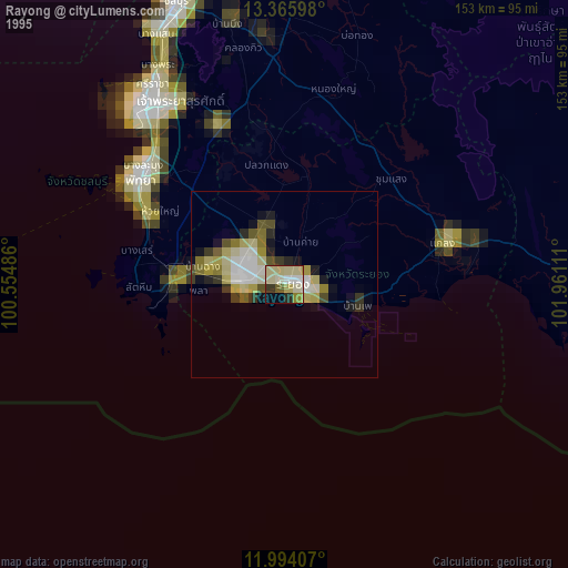
» NASA, Earths city lights 1995
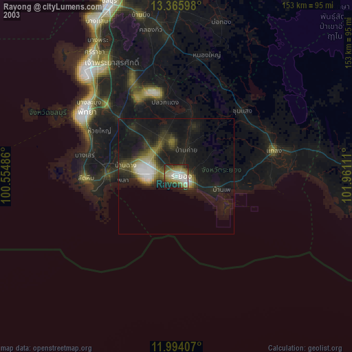
» NASA city lights 2003
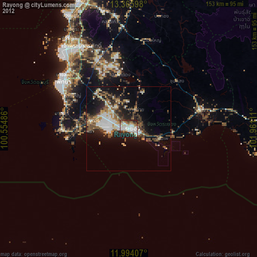
» Earth at Night: Flat Maps 2012, 2016