Pattaya night lights from space
Night Light of Pattaya (Chon Buri) from space (Thailand) Src. Average luminocity for 10x10km area is 71.974% and for 50x50km: 35.4238%.
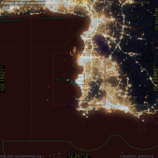
Analysis of Pattaya night lights 2016
Square area 10x10 km:
 31.82%
90-99
24.24%80-89
1.52%70-79
6.71%60-69
2.81%50-59
2.38%40-49
1.3%30-39
5.19%20-29
13.2%10-19
10.39%0-9
0.43%Square area 50x50 km:
5.64%90-99
4.78%80-89
7.34%70-79
7.26%60-69
6.91%50-59
4.15%40-49
5.46%30-39
4.38%20-29
7.09%10-19
6.49%0-9
40.5%Clear (daylight) street map image can be seen on geolist.org.
Map coordinates:
13° 37' 3.6" North, 100° 10' 48.8" East
12° 55' 60" North, 100° 52' 60" East
12° 14' 49.6" North, 101° 35' 11.3" East
Some cities around Pattaya sort by population:
• Chon Buri
48.9 km =30.4 mi,  12°
12°
• Si Racha
27.2 km =16.9 mi, 10°
• Rayong
49.4 km =30.7 mi,  124°
124°
• Sattahip
29.7 km =18.5 mi,  176°
176°
• Bang Lamung
13.6 km =8.5 mi,  21°
21°
• Ban Chang
29.7 km =18.5 mi,  141°
141°
• Ban Talat Bueng
20.1 km =12.5 mi,  40°
40°
• Ban Bueng
48.8 km =30.3 mi,  30°
30°
1614295 (p: 97,296)
Sources (retrieved 2019-11-25):
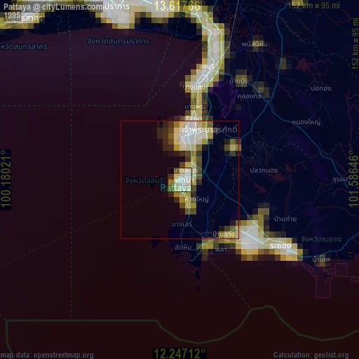
» NASA, Earths city lights 1995
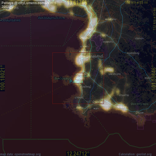
» NASA city lights 2003
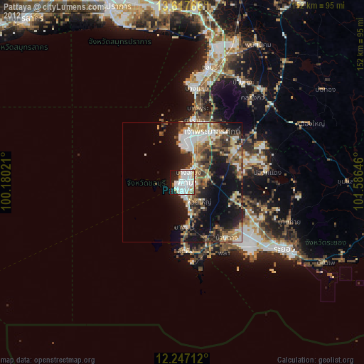
» Earth at Night: Flat Maps 2012, 2016