Kathu night lights from space
Night Light of Kathu (Phuket) from space (Thailand) Src. Average luminocity for 10x10km area is 66.8533% and for 50x50km: 16.2144%.
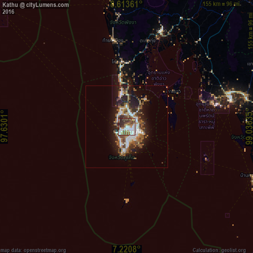
Analysis of Kathu night lights 2016
Square area 10x10 km:
 19.63%
90-99
15.91%80-89
3.31%70-79
6.82%60-69
8.68%50-59
11.57%40-49
8.47%30-39
17.56%20-29
8.06%10-19
0%0-9
0%Square area 50x50 km:
2.95%90-99
3.1%80-89
0.89%70-79
1.3%60-69
2.33%50-59
3.21%40-49
3.46%30-39
2.42%20-29
4.15%10-19
8.88%0-9
67.31%Clear (daylight) street map image can be seen on geolist.org.
Map coordinates:
8° 36' 49" North, 97° 37' 48.4" East
7° 55' 4" North, 98° 19' 59.6" East
7° 13' 14.9" North, 99° 2' 10.9" East
Some cities around Kathu sort by population:
• Phuket
7.8 km =4.8 mi,  112°
112°
• Ban Talat Yai
8.2 km =5.1 mi,  116°
116°
• Wichit
6.5 km =4 mi, 118°
• Ban Ratsada
7.7 km =4.8 mi,  96°
96°
• Ban Talat Nua
6.8 km =4.2 mi, 122°
• Ban Chalong
8.2 km =5.1 mi,  175°
175°
• Patong
4.7 km =2.9 mi,  239°
239°
• Ban Ko Kaeo
7.3 km =4.5 mi,  73°
73°
1153035 (p: 34,835)
Sources (retrieved 2019-11-25):
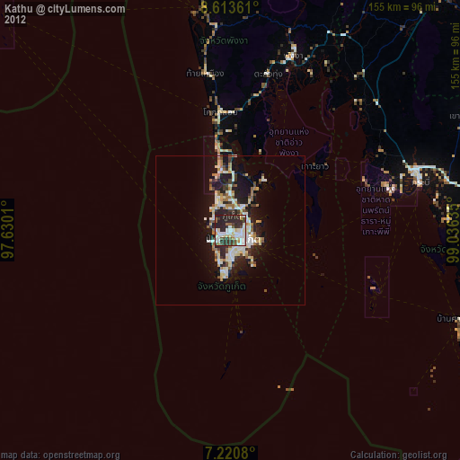
» Earth at Night: Flat Maps 2012, 2016