Den Chai night lights from space
Night Light of Den Chai (Phrae) from space (Thailand) Src. Average luminocity for 10x10km area is 29.9459% and for 50x50km: 7.5007%.
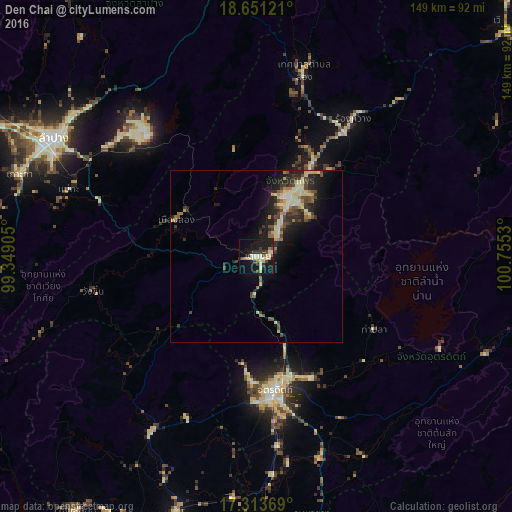
Analysis of Den Chai night lights 2016
Square area 10x10 km:
 1.73%
1.73%90-99
7.58%80-89
5.84%70-79
3.46%60-69
1.73%50-59
1.3%40-49
4.76%30-39
4.55%20-29
6.49%10-19
38.31%0-9
24.24%Square area 50x50 km:
0.27%90-99
1.32%80-89
1.66%70-79
0.64%60-69
0.8%50-59
0.85%40-49
1.47%30-39
1.37%20-29
2.36%10-19
6.06%0-9
83.21%Clear (daylight) street map image can be seen on geolist.org.
Map coordinates:
18° 39' 4.4" North, 99° 20' 56.6" East
17° 59' 1.4" North, 100° 3' 7.8" East
17° 18' 49.3" North, 100° 45' 19.1" East
Some cities around Den Chai sort by population:
• Lampang
68.3 km =42.4 mi,  300°
300°
• Uttaradit
40.1 km =24.9 mi,  173°
173°
• Phrae
20.3 km =12.6 mi,  27°
27°
• Si Satchanalai
60.4 km =37.5 mi,  210°
210°
• Sawankhalok
77.8 km =48.3 mi,  197°
197°
• Thoen
97.6 km =60.6 mi,  245°
245°
• Rong Kwang
48.4 km =30.1 mi,  35°
35°
• Long
25.5 km =15.8 mi,  293°
293°
1610943 (p: 17,019)
Sources (retrieved 2019-11-25):
» Earth at Night: Flat Maps 2012, 2016