Şalākhid night lights from space
Night Light of Şalākhid (As-Suwayda) from space (Syria) Src. Average luminocity for 10x10km area is 3.6117% and for 50x50km: 2.7062%.
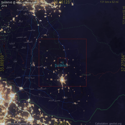
Analysis of Şalākhid night lights 2016
Square area 10x10 km:
 0%
0%90-99
0%80-89
0%70-79
0.37%60-69
0.55%50-59
0.55%40-49
1.28%30-39
2.75%20-29
1.83%10-19
1.83%0-9
90.84%Square area 50x50 km:
0.01%90-99
0.09%80-89
0.47%70-79
0.31%60-69
0.29%50-59
0.39%40-49
0.95%30-39
0.91%20-29
0.76%10-19
2.42%0-9
93.39%Clear (daylight) street map image can be seen on geolist.org.
Map coordinates:
33° 27' 40.6" North, 35° 52' 10.5" East
32° 52' 21.8" North, 36° 34' 21.8" East
32° 16' 48.8" North, 37° 16' 33" East
Some cities around Şalākhid sort by population:
• As-Suwayda
18.2 km =11.3 mi,  180°
180°
• Jāsim
49.6 km =30.8 mi,  285°
285°
• Inkhil
44.5 km =27.7 mi, 291°
• Ash Shaykh Miskīn
38.9 km =24.2 mi,  262°
262°
• Aş Şanamayn
42.6 km =26.5 mi,  301°
301°
• Al Ḩarāk
28.1 km =17.5 mi,  240°
240°
• Shahbā
5.6 km =3.5 mi,  110°
110°
• Izra‘
29.7 km =18.5 mi,  269°
269°
164952 (p: 12,842)
Sources (retrieved 2019-11-25):
» Earth at Night: Flat Maps 2012, 2016