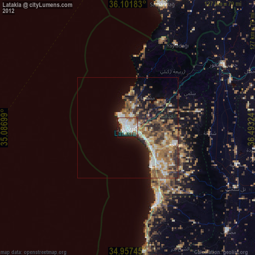
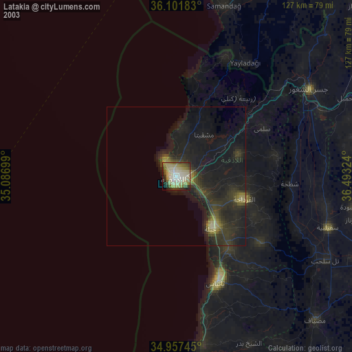
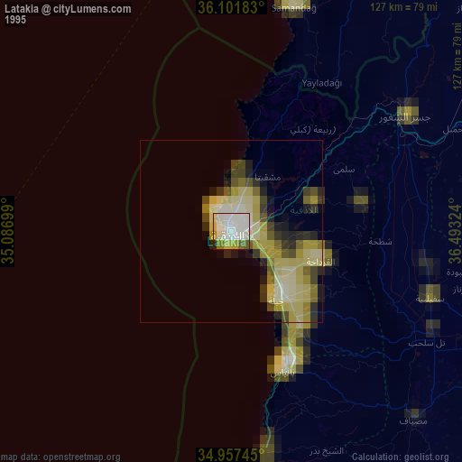
Latakia night lights from space
Night Light of Latakia from space (Syria) Src. Average luminocity for 10x10km area is 59.7399% and for 50x50km: 11.436%.
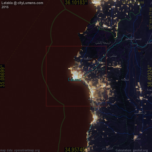
Analysis of Latakia night lights 2016
Square area 10x10 km:
 6.78%
6.78%90-99
19.6%80-89
15.38%70-79
8.06%60-69
5.13%50-59
0.92%40-49
7.69%30-39
5.68%20-29
18.86%10-19
10.81%0-9
1.1%Square area 50x50 km:
0.31%90-99
1.15%80-89
1.45%70-79
1.24%60-69
1.42%50-59
1.76%40-49
4.37%30-39
3.58%20-29
4.64%10-19
7.55%0-9
72.55%Clear (daylight) street map image can be seen on geolist.org.
Map coordinates:
36° 6' 6.6" North, 35° 5' 13.2" East
35° 31' 54" North, 35° 47' 24.4" East
34° 57' 26.8" North, 36° 29' 35.7" East
Some cities around Latakia sort by population:
• Tartouss
72 km =44.7 mi,  173°
173°
• Jablah
22.6 km =14 mi,  146°
146°
• Kafranbel
70.6 km =43.9 mi,  82°
82°
• Jisr ash Shughūr
57.2 km =35.5 mi,  56°
56°
• Bāniyās
41.5 km =25.8 mi,  159°
159°
• Maşyāf
72 km =44.7 mi,  136°
136°
• Yayladağı, TR
48 km =29.8 mi,  30°
30°
• Tremseh
70.9 km =44.1 mi,  114°
114°
173576 (p: 340,181)
Sources (retrieved 2019-11-25):
» NASA, Earths city lights 1995
» NASA city lights 2003
» Earth at Night: Flat Maps 2012, 2016