Jablah night lights from space
Night Light of Jablah (Latakia) from space (Syria) Src. Average luminocity for 10x10km area is 33.033% and for 50x50km: 13.4844%.
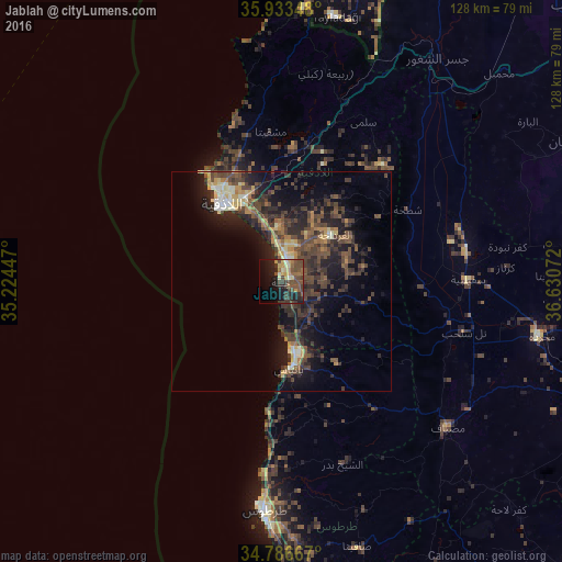
Analysis of Jablah night lights 2016
Square area 10x10 km:
 0%
0%90-99
2.56%80-89
5.86%70-79
4.76%60-69
4.58%50-59
8.42%40-49
13.74%30-39
7.51%20-29
6.78%10-19
22.53%0-9
23.26%Square area 50x50 km:
0.35%90-99
1.41%80-89
1.61%70-79
1.39%60-69
1.61%50-59
2.1%40-49
5.06%30-39
4.23%20-29
5.12%10-19
10.29%0-9
66.82%Clear (daylight) street map image can be seen on geolist.org.
Map coordinates:
35° 56' 0.5" North, 35° 13' 28.1" East
35° 21' 43.6" North, 35° 55' 39.3" East
34° 47' 12" North, 36° 37' 50.6" East
Some cities around Jablah sort by population:
• Latakia
22.6 km =14 mi,  326°
326°
• Tartouss
52.7 km =32.7 mi,  184°
184°
• Bāniyās
20.1 km =12.5 mi,  174°
174°
• Maşyāf
50 km =31.1 mi,  131°
131°
• Kafr Zaytā
61.3 km =38.1 mi,  88°
88°
• Ad Duraykīsh
55.5 km =34.5 mi,  159°
159°
• Yayladağı, TR
61.3 km =38.1 mi,  11°
11°
• Tremseh
53.2 km =33.1 mi,  100°
100°
169304 (p: 65,915)
Sources (retrieved 2019-11-25):
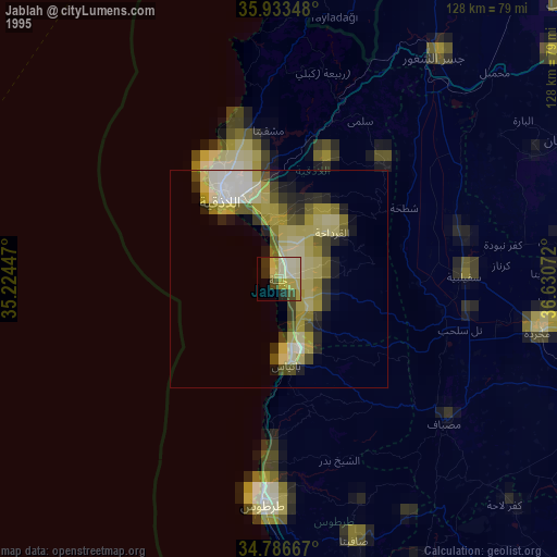
» NASA, Earths city lights 1995
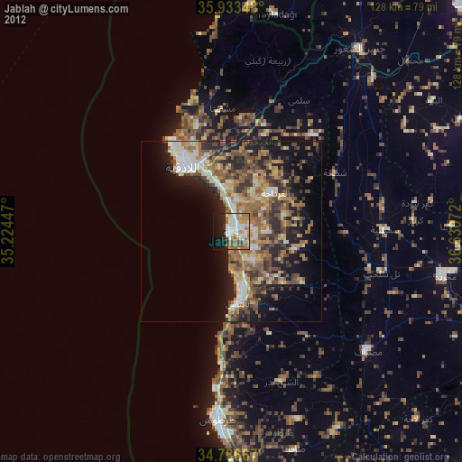
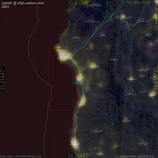
» NASA city lights 2003
» Earth at Night: Flat Maps 2012, 2016