Kafr Lāhā night lights from space
Night Light of Kafr Lāhā (Homs) from space (Syria) Src. Average luminocity for 10x10km area is 0.2674% and for 50x50km: 6.4305%.
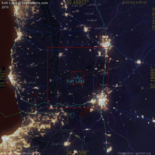
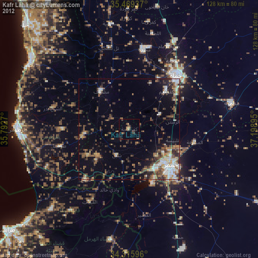
Analysis of Kafr Lāhā night lights 2016
Square area 10x10 km:
 0%
0%90-99
0%80-89
0%70-79
0%60-69
0%50-59
0%40-49
0%30-39
0.73%20-29
0%10-19
0%0-9
99.27%Square area 50x50 km:
0.27%90-99
0.93%80-89
1.28%70-79
0.54%60-69
0.63%50-59
0.95%40-49
1.7%30-39
1.81%20-29
2.61%10-19
3.1%0-9
86.19%Clear (daylight) street map image can be seen on geolist.org.
Map coordinates:
35° 28' 9.7" North, 35° 47' 33.7" East
34° 53' 40.9" North, 36° 29' 45" East
34° 18' 57.5" North, 37° 11' 56.2" East
Some cities around Kafr Lāhā sort by population:
• Homs
27.9 km =17.3 mi,  131°
131°
• Ar Rastan
21.9 km =13.6 mi,  80°
80°
• Tallbīsah
22.3 km =13.9 mi,  105°
105°
• Maşyāf
23.7 km =14.7 mi,  323°
323°
• Tallkalakh
33.1 km =20.6 mi,  220°
220°
• Satita
35.5 km =22.1 mi,  256°
256°
• Ad Duraykīsh
32.2 km =20 mi,  270°
270°
• Al Ghanţū
20 km =12.4 mi, 113°
168668 (p: 21,819)
Sources (retrieved 2019-11-25):
» Earth at Night: Flat Maps 2012, 2016