As Safīrah night lights from space
Night Light of As Safīrah (Aleppo) from space (Syria) Src. Average luminocity for 10x10km area is 0% and for 50x50km: 1.1795%.
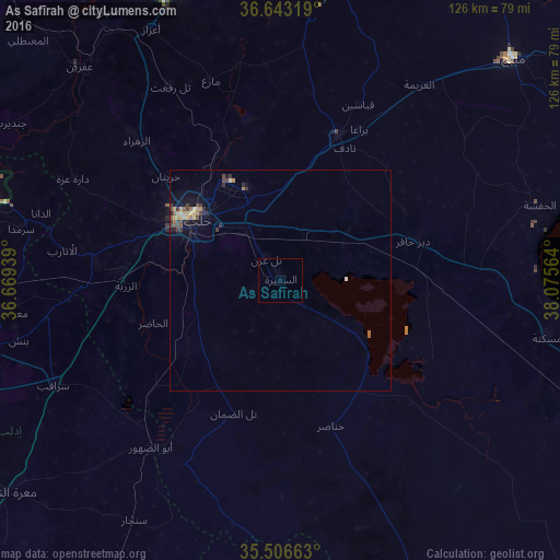
Analysis of As Safīrah night lights 2016
Square area 10x10 km:
 0%
0%90-99
0%80-89
0%70-79
0%60-69
0%50-59
0%40-49
0%30-39
0%20-29
0%10-19
0%0-9
100%Square area 50x50 km:
0%90-99
0.08%80-89
0.24%70-79
0.18%60-69
0.2%50-59
0.14%40-49
0.27%30-39
0.3%20-29
0.27%10-19
0.65%0-9
97.65%Clear (daylight) street map image can be seen on geolist.org.
Map coordinates:
36° 38' 35.5" North, 36° 40' 9.8" East
36° 4' 37.1" North, 37° 22' 21" East
35° 30' 23.9" North, 38° 4' 32.3" East
Some cities around As Safīrah sort by population:
• Aleppo
23.5 km =14.6 mi,  306°
306°
• Al Bāb
35.1 km =21.8 mi,  21°
21°
• Tādif
33.3 km =20.7 mi,  25°
25°
• Sarāqib
56.2 km =34.9 mi,  245°
245°
• Dayr Ḩāfir
31.4 km =19.5 mi,  73°
73°
• Tall Rif‘at
50.5 km =31.4 mi,  330°
330°
• Nubl
47.8 km =29.7 mi, 314°
• Ad Dānā
56.2 km =34.9 mi,  285°
285°
172503 (p: 63,708)
Sources (retrieved 2019-11-25):
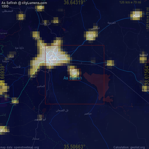
» NASA, Earths city lights 1995
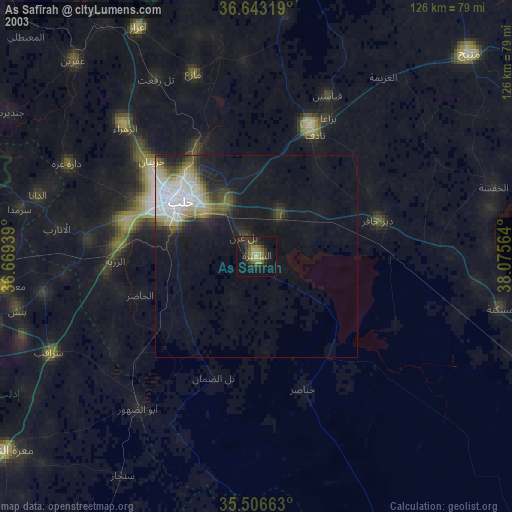
» NASA city lights 2003
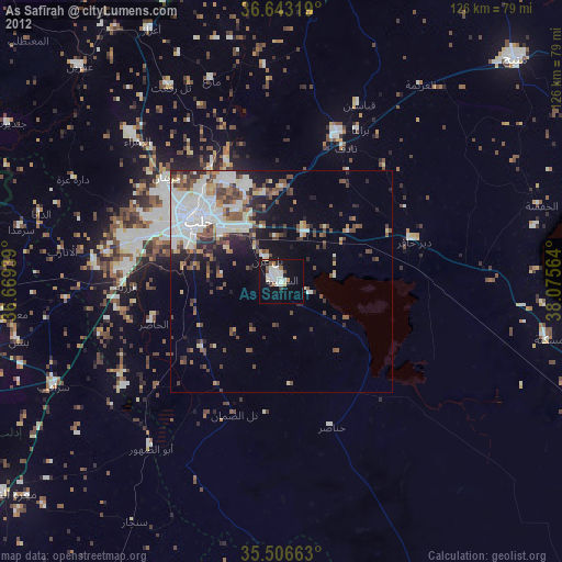
» Earth at Night: Flat Maps 2012, 2016