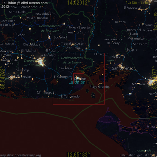
La Unión night lights from space
Night Light of La Unión from space (El Salvador) Src. Average luminocity for 10x10km area is 8.2769% and for 50x50km: 0.5041%.
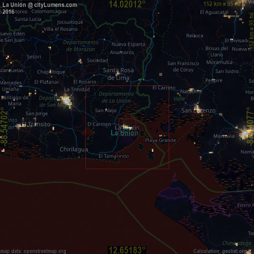
Analysis of La Unión night lights 2016
Square area 10x10 km:
 0.83%
0.83%90-99
0%80-89
1.45%70-79
1.86%60-69
1.65%50-59
2.48%40-49
1.65%30-39
0.83%20-29
0%10-19
1.24%0-9
88.02%Square area 50x50 km:
0.03%90-99
0%80-89
0.09%70-79
0.11%60-69
0.1%50-59
0.17%40-49
0.07%30-39
0.07%20-29
0.04%10-19
0.12%0-9
99.21%Clear (daylight) street map image can be seen on geolist.org.
Map coordinates:
14° 1' 12.4" North, 88° 32' 49.3" West
13° 20' 13" North, 87° 50' 38" West
12° 39' 6.6" North, 87° 8' 26.8" West
Some cities around La Unión sort by population:
• San Miguel
40.2 km =25 mi,  293°
293°
• San Lorenzo, HN
44 km =27.3 mi,  77°
77°
• San Francisco
49 km =30.4 mi,  325°
325°
• Nacaome, HN
44.5 km =27.7 mi,  60°
60°
• Santa Rosa de Lima
32.4 km =20.1 mi,  350°
350°
• La Alianza, HN
23.4 km =14.5 mi,  33°
33°
• Chirilagua
34.4 km =21.4 mi,  247°
247°
• San Alejo
16.6 km =10.3 mi,  309°
309°
3584772 (p: 26,807)
Sources (retrieved 2019-11-25):
» Earth at Night: Flat Maps 2012, 2016