San Alejo night lights from space
Night Light of San Alejo (La Unión) from space (El Salvador) Src. Average luminocity for 10x10km area is 0.5227% and for 50x50km: 1.7279%.
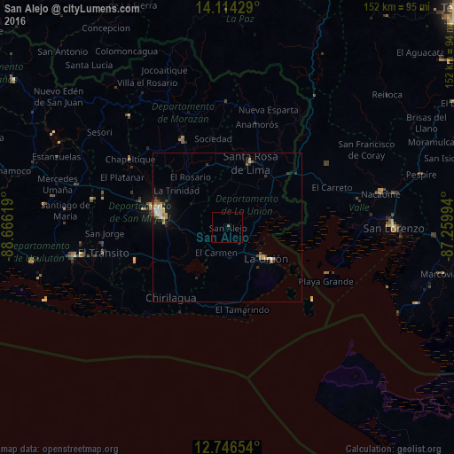
Analysis of San Alejo night lights 2016
Square area 10x10 km:
 0%
0%90-99
0%80-89
0%70-79
0%60-69
0%50-59
0.83%40-49
0%30-39
0%20-29
0%10-19
0%0-9
99.17%Square area 50x50 km:
0.12%90-99
0.22%80-89
0.41%70-79
0.14%60-69
0.23%50-59
0.36%40-49
0.14%30-39
0.32%20-29
0.18%10-19
1.21%0-9
96.67%Clear (daylight) street map image can be seen on geolist.org.
Map coordinates:
14° 6' 51.4" North, 88° 39' 58.3" West
13° 25' 53" North, 87° 57' 47" West
12° 44' 47.5" North, 87° 15' 35.8" West
Some cities around San Alejo sort by population:
• San Miguel
24.5 km =15.2 mi,  283°
283°
• La Unión
16.6 km =10.3 mi,  129°
129°
• San Rafael Oriente
42.2 km =26.2 mi,  262°
262°
• San Francisco
33.3 km =20.7 mi,  333°
333°
• Santa Rosa de Lima
22.8 km =14.2 mi,  19°
19°
• La Alianza, HN
27.3 km =17 mi,  70°
70°
• Chirilagua
30.2 km =18.8 mi,  218°
218°
• Guatajiagua
36.6 km =22.7 mi,  315°
315°
3583905 (p: 5,149)
Sources (retrieved 2019-11-25):
» Earth at Night: Flat Maps 2012, 2016