Chalchuapa night lights from space
Night Light of Chalchuapa (Santa Ana) from space (El Salvador) Src. Average luminocity for 10x10km area is 20.1082% and for 50x50km: 5.2394%.
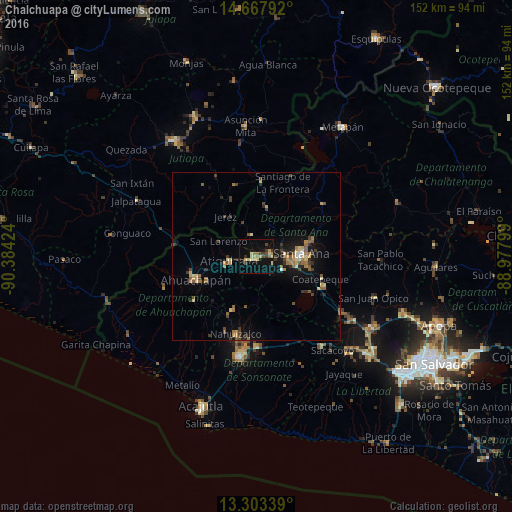
Analysis of Chalchuapa night lights 2016
Square area 10x10 km:
 0%
0%90-99
0.22%80-89
7.36%70-79
3.25%60-69
1.52%50-59
2.38%40-49
4.76%30-39
2.6%20-29
1.73%10-19
14.94%0-9
61.26%Square area 50x50 km:
0.1%90-99
0.28%80-89
0.94%70-79
0.76%60-69
0.88%50-59
0.96%40-49
0.92%30-39
1%20-29
0.77%10-19
4.06%0-9
89.34%Clear (daylight) street map image can be seen on geolist.org.
Map coordinates:
14° 40' 4.5" North, 90° 23' 3.3" West
13° 59' 12" North, 89° 40' 52" West
13° 18' 12.2" North, 88° 58' 40.8" West
Some cities around Chalchuapa sort by population:
• Santa Ana
13.1 km =8.1 mi,  86°
86°
• Ahuachapán
19.1 km =11.9 mi,  247°
247°
• Atescatempa, GT
21.9 km =13.6 mi,  342°
342°
• Juayúa
17.6 km =10.9 mi,  203°
203°
• Atiquizaya
7.8 km =4.8 mi,  262°
262°
• El Congo
21.8 km =13.5 mi,  113°
113°
• Candelaria de La Frontera
14.8 km =9.2 mi,  13°
13°
• Coatepeque
20.2 km =12.6 mi, 108°
3587086 (p: 32,282)
Sources (retrieved 2019-11-25):
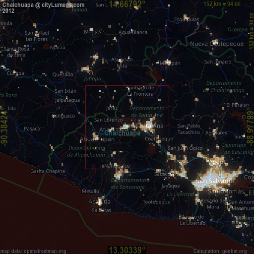
» Earth at Night: Flat Maps 2012, 2016