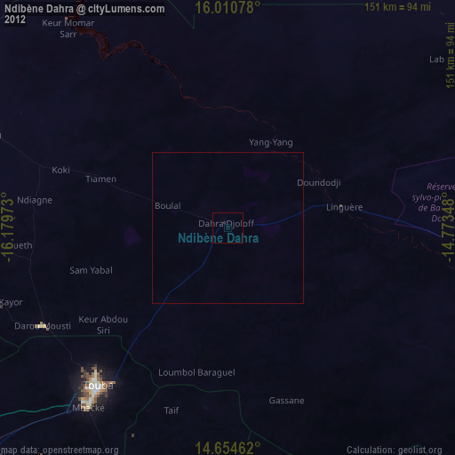
Ndibène Dahra night lights from space
Night Light of Ndibène Dahra (Louga) from space (Senegal) Src. Average luminocity for 10x10km area is 0.6017% and for 50x50km: 0.0232%.
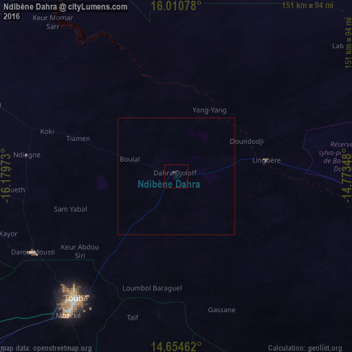
Analysis of Ndibène Dahra night lights 2016
Square area 10x10 km:
 0%
0%90-99
0%80-89
0%70-79
0%60-69
0%50-59
0.87%40-49
0%30-39
0%20-29
0%10-19
0.87%0-9
98.27%Square area 50x50 km:
0%90-99
0%80-89
0%70-79
0%60-69
0%50-59
0.03%40-49
0%30-39
0%20-29
0%10-19
0.03%0-9
99.93%Clear (daylight) street map image can be seen on geolist.org.
Map coordinates:
16° 0' 38.8" North, 16° 10' 47" West
15° 20' 1.7" North, 15° 28' 35.8" West
14° 39' 16.6" North, 14° 46' 24.5" West
Some cities around Ndibène Dahra sort by population:
• Touba
69.3 km =43.1 mi,  219°
219°
• Tiébo
112.6 km =70 mi,  226°
226°
• Mbaké
76.1 km =47.3 mi, 217°
• Louga
86.2 km =53.6 mi,  291°
291°
• Dara
1.7 km =1.1 mi,  347°
347°
• Mékhé
125.4 km =77.9 mi,  258°
258°
• Guéoul
95.1 km =59.1 mi,  280°
280°
• Diourbel
112.3 km =69.8 mi, 227°
2247813 (p: 27,741)
Sources (retrieved 2019-11-25):
» Earth at Night: Flat Maps 2012, 2016