Guéoul night lights from space
Night Light of Guéoul (Louga) from space (Senegal) Src. Average luminocity for 10x10km area is 0% and for 50x50km: 0.4252%.
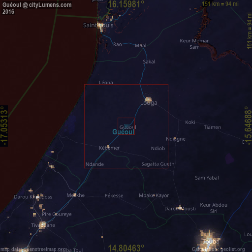
Analysis of Guéoul night lights 2016
Square area 10x10 km:
100  0%
0%
90-99 0%
80-89 0%
70-79 0%
60-69 0%
50-59 0%
40-49 0%
30-39 0%
20-29 0%
10-19 0%
0-9 100%
0%90-99
0%80-89
0%70-79
0%60-69
0%50-59
0%40-49
0%30-39
0%20-29
0%10-19
0%0-9
100%Square area 50x50 km:
100 0%
90-99 0.03%
80-89 0%
70-79 0.16%
60-69 0.13%
50-59 0.05%
40-49 0.12%
30-39 0.08%
20-29 0.08%
10-19 0%
0-9 99.37%
0%90-99
0.03%80-89
0%70-79
0.16%60-69
0.13%50-59
0.05%40-49
0.12%30-39
0.08%20-29
0.08%10-19
0%0-9
99.37%Clear (daylight) street map image can be seen on geolist.org.
Map coordinates:
16° 9' 35.3" North, 17° 3' 11.3" West
15° 28' 60" North, 16° 21' 0" West
14° 48' 16.7" North, 15° 38' 48.8" West
Some cities around Guéoul sort by population:
• Touba
86.4 km =53.7 mi,  144°
144°
• Saint-Louis
61.3 km =38.1 mi,  345°
345°
• Mbaké
90.5 km =56.2 mi,  148°
148°
• Louga
20.2 km =12.6 mi,  41°
41°
• Dara
94.5 km =58.7 mi,  99°
99°
• Mékhé
50.8 km =31.6 mi,  215°
215°
• Khombole
88.1 km =54.7 mi,  205°
205°
• Diourbel
93.6 km =58.2 mi,  172°
172°
2251292 (p: 10,918)
Sources (retrieved 2019-11-25):
» Earth at Night: Flat Maps 2012, 2016