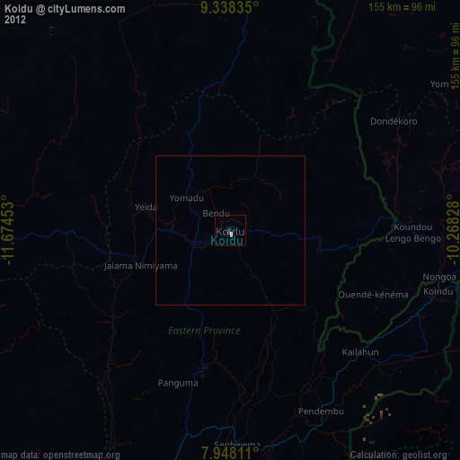
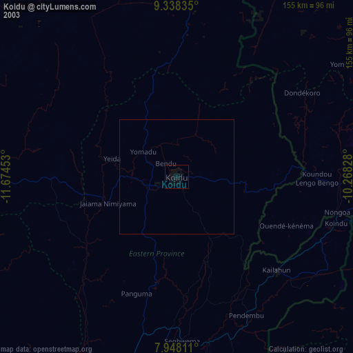
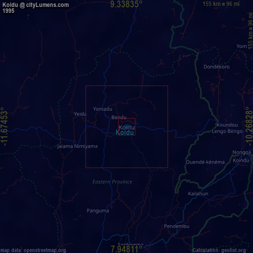
Koidu night lights from space
Night Light of Koidu (Eastern Province) from space (Sierra Leone) Src. Average luminocity for 10x10km area is 5.5847% and for 50x50km: 0.2322%.
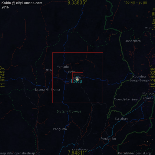
Analysis of Koidu night lights 2016
Square area 10x10 km:
 0.41%
0.41%90-99
0.41%80-89
0%70-79
1.65%60-69
1.86%50-59
1.45%40-49
0.83%30-39
0%20-29
1.65%10-19
0%0-9
91.74%Square area 50x50 km:
0.02%90-99
0.02%80-89
0%70-79
0.07%60-69
0.08%50-59
0.06%40-49
0.03%30-39
0%20-29
0.07%10-19
0%0-9
99.66%Clear (daylight) street map image can be seen on geolist.org.
Map coordinates:
9° 20' 18.1" North, 11° 40' 28.3" West
8° 38' 37.9" North, 10° 58' 17" West
7° 56' 53.2" North, 10° 16' 5.8" West
Some cities around Koidu sort by population:
• Kailahun
59.7 km =37.1 mi,  132°
132°
• Yengema
23.3 km =14.5 mi,  289°
289°
• Pendembu
67.9 km =42.2 mi,  153°
153°
• Panguma
54 km =33.6 mi,  199°
199°
• Barma
51.3 km =31.9 mi,  230°
230°
• Boajibu
65 km =40.4 mi,  218°
218°
• Bunumbu
53.5 km =33.2 mi,  167°
167°
• Motema
5.6 km =3.5 mi, 233°
2407656 (p: 88,000)
Sources (retrieved 2019-11-25):
» NASA, Earths city lights 1995
» NASA city lights 2003
» Earth at Night: Flat Maps 2012, 2016