Kailahun night lights from space
Night Light of Kailahun (Eastern Province) from space (Sierra Leone) Src. Average luminocity for 10x10km area is 0% and for 50x50km: 0.0077%.
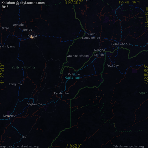
Analysis of Kailahun night lights 2016
Square area 10x10 km:
 0%
0%90-99
0%80-89
0%70-79
0%60-69
0%50-59
0%40-49
0%30-39
0%20-29
0%10-19
0%0-9
100%Square area 50x50 km:
0%90-99
0%80-89
0%70-79
0%60-69
0%50-59
0%40-49
0%30-39
0%20-29
0.03%10-19
0%0-9
99.97%Clear (daylight) street map image can be seen on geolist.org.
Map coordinates:
8° 58' 26.7" North, 11° 16' 34.1" West
8° 16' 44" North, 10° 34' 22.8" West
7° 34' 57" North, 9° 52' 11.6" West
Some cities around Kailahun sort by population:
• Koidu
59.7 km =37.1 mi,  312°
312°
• Gueckedou, GN
58 km =36 mi,  56°
56°
• Segbwema
52.2 km =32.4 mi,  232°
232°
• Pendembu
24.1 km =15 mi,  213°
213°
• Bunumbu
34.1 km =21.2 mi,  250°
250°
• Tombodu
16.8 km =10.4 mi,  197°
197°
• Daru
43.7 km =27.2 mi,  222°
222°
• Buedu
22.2 km =13.8 mi,  89°
89°
2408250 (p: 14,085)
Sources (retrieved 2019-11-25):
» Earth at Night: Flat Maps 2012, 2016