Bonthe night lights from space
Night Light of Bonthe (Southern Province) from space (Sierra Leone) Src. Average luminocity for 10x10km area is 0% and for 50x50km: 0.0211%.
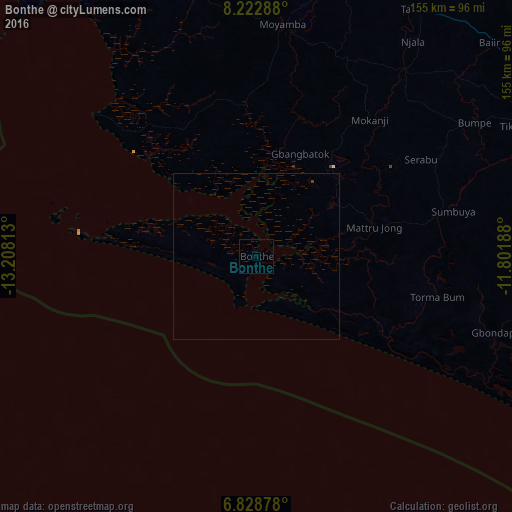
Analysis of Bonthe night lights 2016
Square area 10x10 km:
 0%
0%90-99
0%80-89
0%70-79
0%60-69
0%50-59
0%40-49
0%30-39
0%20-29
0%10-19
0%0-9
100%Square area 50x50 km:
0%90-99
0%80-89
0%70-79
0%60-69
0%50-59
0%40-49
0.03%30-39
0%20-29
0%10-19
0%0-9
99.97%Clear (daylight) street map image can be seen on geolist.org.
Map coordinates:
8° 13' 22.4" North, 13° 12' 29.3" West
7° 31' 35" North, 12° 30' 18" West
6° 49' 43.6" North, 11° 48' 6.8" West
Some cities around Bonthe sort by population:
• Bo
97.5 km =60.6 mi,  60°
60°
• Bumpe
77.6 km =48.2 mi, 58°
• Gandorhun
89.6 km =55.7 mi,  87°
87°
• Gandorhun
74.4 km =46.2 mi, 92°
• Pujehun
88.5 km =55 mi,  102°
102°
• Sumbuya
61.5 km =38.2 mi,  77°
77°
• Baoma
101.4 km =63 mi, 59°
• Moyamba
70.8 km =44 mi,  6°
6°
2409914 (p: 9,647)
Sources (retrieved 2019-11-25):
» Earth at Night: Flat Maps 2012, 2016