Svit night lights from space
Night Light of Svit (Prešovský kraj) from space (Slovakia) Src. Average luminocity for 10x10km area is 7.314% and for 50x50km: 1.3821%.
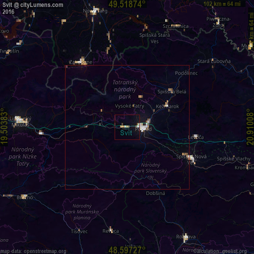
Analysis of Svit night lights 2016
Square area 10x10 km:
 1.19%
1.19%90-99
0.6%80-89
0.6%70-79
1.79%60-69
0.3%50-59
1.04%40-49
0.45%30-39
0.6%20-29
0.3%10-19
2.98%0-9
90.18%Square area 50x50 km:
0.23%90-99
0.19%80-89
0.07%70-79
0.15%60-69
0.15%50-59
0.21%40-49
0.28%30-39
0.13%20-29
0.09%10-19
0.64%0-9
97.85%Clear (daylight) street map image can be seen on geolist.org.
Map coordinates:
49° 31' 7.5" North, 19° 30' 13.8" East
49° 3' 36.5" North, 20° 12' 25" East
48° 35' 50.2" North, 20° 54' 36.3" East
Some cities around Svit sort by population:
• Poprad
6.6 km =4.1 mi,  88°
88°
• Spišská Nová Ves
28.9 km =18 mi,  116°
116°
• Zakopane, PL
32.5 km =20.2 mi,  324°
324°
• Kežmarok
18.5 km =11.5 mi,  63°
63°
• Levoča
28.4 km =17.6 mi,  98°
98°
• Revúca
42.4 km =26.3 mi,  188°
188°
• Liptovský Hrádok
35.3 km =21.9 mi,  266°
266°
• Spišská Belá
23.2 km =14.4 mi,  52°
52°
723411 (p: 7,445)
Sources (retrieved 2019-11-25):
» Earth at Night: Flat Maps 2012, 2016