Levoča night lights from space
Night Light of Levoča (Prešovský kraj) from space (Slovakia) Src. Average luminocity for 10x10km area is 2.8051% and for 50x50km: 1.5068%.
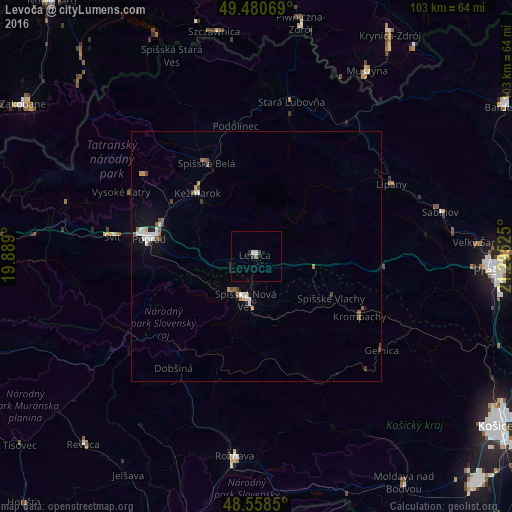
Analysis of Levoča night lights 2016
Square area 10x10 km:
 0.74%
0.74%90-99
0.45%80-89
0%70-79
0%60-69
0%50-59
0.6%40-49
0.3%30-39
0.45%20-29
1.04%10-19
0%0-9
96.43%Square area 50x50 km:
0.3%90-99
0.26%80-89
0.09%70-79
0.1%60-69
0.17%50-59
0.26%40-49
0.3%30-39
0.07%20-29
0.11%10-19
0.63%0-9
97.7%Clear (daylight) street map image can be seen on geolist.org.
Map coordinates:
49° 28' 50.5" North, 19° 53' 20.4" East
49° 1' 18.2" North, 20° 35' 31.6" East
48° 33' 30.6" North, 21° 17' 42.9" East
Some cities around Levoča sort by population:
• Poprad
21.9 km =13.6 mi,  281°
281°
• Spišská Nová Ves
8.9 km =5.5 mi,  194°
194°
• Kežmarok
17.1 km =10.6 mi,  317°
317°
• Krompachy
23.9 km =14.9 mi,  119°
119°
• Svit
28.4 km =17.6 mi, 278°
• Gelnica
31.2 km =19.4 mi,  126°
126°
• Spišská Belá
20.8 km =12.9 mi,  332°
332°
• Lipany
30.8 km =19.1 mi,  61°
61°
724294 (p: 14,511)
Sources (retrieved 2019-11-25):
» Earth at Night: Flat Maps 2012, 2016