Krompachy night lights from space
Night Light of Krompachy (Košický kraj) from space (Slovakia) Src. Average luminocity for 10x10km area is 1.0625% and for 50x50km: 1.0665%.
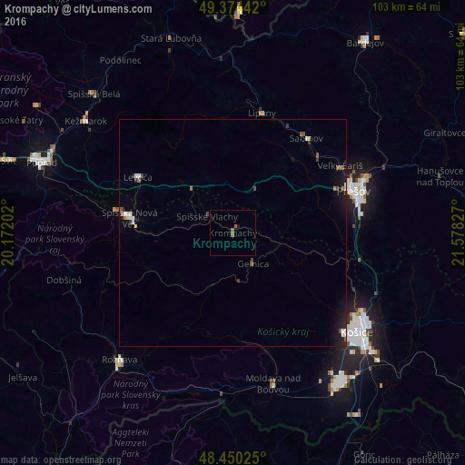
Analysis of Krompachy night lights 2016
Square area 10x10 km:
 0%
0%90-99
0%80-89
0%70-79
0%60-69
0.14%50-59
1.56%40-49
0%30-39
0%20-29
0%10-19
0.57%0-9
97.73%Square area 50x50 km:
0.14%90-99
0.13%80-89
0.05%70-79
0.04%60-69
0.16%50-59
0.23%40-49
0.16%30-39
0.1%20-29
0.22%10-19
0.97%0-9
97.82%Clear (daylight) street map image can be seen on geolist.org.
Map coordinates:
49° 22' 27.9" North, 20° 10' 19.3" East
48° 54' 52.1" North, 20° 52' 30.5" East
48° 27' 0.9" North, 21° 34' 41.8" East
Some cities around Krompachy sort by population:
• Košice
35.8 km =22.2 mi,  128°
128°
• Prešov
27.8 km =17.3 mi,  70°
70°
• Spišská Nová Ves
23.2 km =14.4 mi,  278°
278°
• Levoča
23.9 km =14.9 mi,  299°
299°
• Sabinov
26.6 km =16.5 mi,  37°
37°
• Moldava nad Bodvou
34.6 km =21.5 mi,  164°
164°
• Gelnica
7.9 km =4.9 mi,  145°
145°
• Lipany
27.4 km =17 mi,  13°
13°
724377 (p: 8,812)
Sources (retrieved 2019-11-25):
» Earth at Night: Flat Maps 2012, 2016