Železniki night lights from space
Night Light of Železniki from space (Slovenia) Src. Average luminocity for 10x10km area is 0.8065% and for 50x50km: 5.1054%.
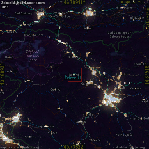
Analysis of Železniki night lights 2016
Square area 10x10 km:
 0%
0%90-99
0%80-89
0%70-79
0%60-69
1.19%50-59
0%40-49
0%30-39
0%20-29
0%10-19
0%0-9
98.81%Square area 50x50 km:
0.68%90-99
0.8%80-89
0.5%70-79
0.43%60-69
0.58%50-59
0.67%40-49
0.8%30-39
0.86%20-29
1.32%10-19
3.84%0-9
89.52%Clear (daylight) street map image can be seen on geolist.org.
Map coordinates:
46° 42' 32.8" North, 13° 28' 8.1" East
46° 13' 29.4" North, 14° 10' 19.4" East
45° 44' 10.4" North, 14° 52' 30.6" East
Some cities around Železniki sort by population:
• Kranj
14.2 km =8.8 mi,  83°
83°
• Škofja Loka
12.3 km =7.6 mi,  122°
122°
• Radovljica
13.3 km =8.3 mi,  0°
0°
• Bled
16.7 km =10.4 mi,  344°
344°
• Bohinjska Bistrica
17.6 km =10.9 mi,  287°
287°
• Naklo
12.4 km =7.7 mi,  64°
64°
• Cerkno
18.3 km =11.4 mi,  233°
233°
• Gorenja Vas
13.2 km =8.2 mi,  188°
188°
3186607 (p: 3,075)
Sources (retrieved 2019-11-25):
» Earth at Night: Flat Maps 2012, 2016