Gorenja Vas night lights from space
Night Light of Gorenja Vas (Gorenja Vas-Poljane) from space (Slovenia) Src. Average luminocity for 10x10km area is 0.0057% and for 50x50km: 3.9713%.
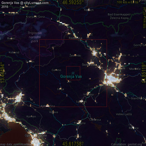
Analysis of Gorenja Vas night lights 2016
Square area 10x10 km:
 0%
0%90-99
0%80-89
0%70-79
0%60-69
0%50-59
0%40-49
0%30-39
0%20-29
0%10-19
0%0-9
100%Square area 50x50 km:
0.43%90-99
0.55%80-89
0.35%70-79
0.39%60-69
0.49%50-59
0.55%40-49
0.52%30-39
0.74%20-29
1.03%10-19
3.68%0-9
91.26%Clear (daylight) street map image can be seen on geolist.org.
Map coordinates:
46° 35' 33.2" North, 13° 26' 41.8" East
46° 6' 26" North, 14° 8' 53" East
45° 37' 3.3" North, 14° 51' 4.3" East
Some cities around Gorenja Vas sort by population:
• Škofja Loka
13.8 km =8.6 mi,  61°
61°
• Vrhnika
19.6 km =12.2 mi,  144°
144°
• Idrija
14.7 km =9.1 mi,  217°
217°
• Žiri
7.9 km =4.9 mi,  203°
203°
• Železniki
13.2 km =8.2 mi,  8°
8°
• Log pri Brezovici
19.6 km =12.2 mi,  120°
120°
• Cerkno
13 km =8.1 mi,  279°
279°
• Horjul
14.9 km =9.3 mi,  128°
128°
3200379 (p: 1,192)
Sources (retrieved 2019-11-25):
» Earth at Night: Flat Maps 2012, 2016