Bohinjska Bistrica night lights from space
Night Light of Bohinjska Bistrica (Bohinj) from space (Slovenia) Src. Average luminocity for 10x10km area is 0.5938% and for 50x50km: 1.0341%.
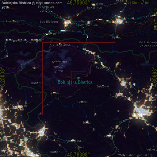
Analysis of Bohinjska Bistrica night lights 2016
Square area 10x10 km:
 0%
0%90-99
0%80-89
0%70-79
0%60-69
0%50-59
0%40-49
0%30-39
1.04%20-29
0.74%10-19
0%0-9
98.21%Square area 50x50 km:
0.05%90-99
0.18%80-89
0.13%70-79
0.11%60-69
0.11%50-59
0.15%40-49
0.22%30-39
0.26%20-29
0.16%10-19
0.08%0-9
98.56%Clear (daylight) street map image can be seen on geolist.org.
Map coordinates:
46° 45' 21.7" North, 13° 15' 1.4" East
46° 16' 19.8" North, 13° 57' 12.6" East
45° 47' 2.3" North, 14° 39' 23.9" East
Some cities around Bohinjska Bistrica sort by population:
• Jesenice
19.6 km =12.2 mi,  26°
26°
• Radovljica
18.8 km =11.7 mi,  64°
64°
• Bled
16.4 km =10.2 mi,  48°
48°
• Tolmin
19.6 km =12.2 mi,  239°
239°
• Železniki
17.6 km =10.9 mi,  107°
107°
• Cerkno
16.4 km =10.2 mi,  172°
172°
• Žirovnica
20.5 km =12.7 mi,  44°
44°
• Zgornje Gorje
14.9 km =9.3 mi, 36°
3203808 (p: 1,799)
Sources (retrieved 2019-11-25):
» Earth at Night: Flat Maps 2012, 2016