Kranj night lights from space
Night Light of Kranj from space (Slovenia) Src. Average luminocity for 10x10km area is 25.5104% and for 50x50km: 8.8441%.
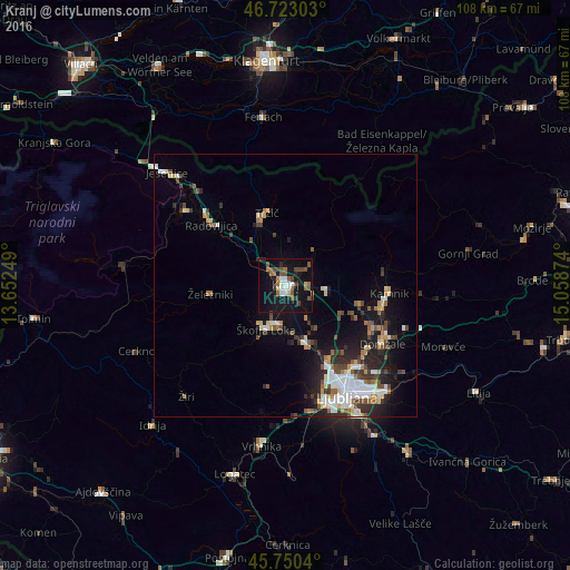
Analysis of Kranj night lights 2016
Square area 10x10 km:
100  3.42%
3.42%
90-99 2.53%
80-89 1.19%
70-79 1.19%
60-69 5.21%
50-59 5.65%
40-49 5.8%
30-39 2.98%
20-29 3.57%
10-19 38.69%
0-9 29.76%
3.42%90-99
2.53%80-89
1.19%70-79
1.19%60-69
5.21%50-59
5.65%40-49
5.8%30-39
2.98%20-29
3.57%10-19
38.69%0-9
29.76%Square area 50x50 km:
100 1.39%
90-99 1.58%
80-89 0.8%
70-79 0.75%
60-69 1%
50-59 1.2%
40-49 1.5%
30-39 1.22%
20-29 2.21%
10-19 6.31%
0-9 82.03%
1.39%90-99
1.58%80-89
0.8%70-79
0.75%60-69
1%50-59
1.2%40-49
1.5%30-39
1.22%20-29
2.21%10-19
6.31%0-9
82.03%Clear (daylight) street map image can be seen on geolist.org.
Map coordinates:
46° 43' 22.9" North, 13° 39' 9" East
46° 14' 19.9" North, 14° 21' 20.2" East
45° 45' 1.4" North, 15° 3' 31.5" East
Some cities around Kranj sort by population:
• Škofja Loka
9 km =5.6 mi,  204°
204°
• Medvode
11.6 km =7.2 mi,  158°
158°
• Šenčur
5 km =3.1 mi,  81°
81°
• Železniki
14.2 km =8.8 mi,  263°
263°
• Naklo
4.8 km =3 mi,  321°
321°
• Cerklje na Gorenjskem
10.4 km =6.5 mi, 80°
• Vodice
12 km =7.5 mi,  116°
116°
• Preddvor
8.8 km =5.5 mi,  36°
36°
3197378 (p: 36,874)
Sources (retrieved 2019-11-25):
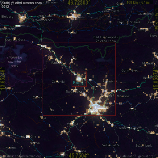
» Earth at Night: Flat Maps 2012, 2016