Naklo night lights from space
Night Light of Naklo from space (Slovenia) Src. Average luminocity for 10x10km area is 15.744% and for 50x50km: 7.4697%.
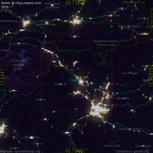
Analysis of Naklo night lights 2016
Square area 10x10 km:
 2.53%
2.53%90-99
2.23%80-89
1.19%70-79
0%60-69
4.17%50-59
2.08%40-49
3.13%30-39
1.64%20-29
2.98%10-19
11.76%0-9
68.3%Square area 50x50 km:
1.09%90-99
1.23%80-89
0.65%70-79
0.68%60-69
0.91%50-59
0.96%40-49
1.38%30-39
1.02%20-29
1.82%10-19
5.74%0-9
84.53%Clear (daylight) street map image can be seen on geolist.org.
Map coordinates:
46° 45' 23.9" North, 13° 36' 50.8" East
46° 16' 22" North, 14° 19' 2" East
45° 47' 4.6" North, 15° 1' 13.3" East
Some cities around Naklo sort by population:
• Kranj
4.8 km =3 mi,  141°
141°
• Škofja Loka
12 km =7.5 mi,  184°
184°
• Radovljica
13.6 km =8.5 mi,  306°
306°
• Tržič
10.1 km =6.3 mi,  357°
357°
• Šenčur
8.4 km =5.2 mi,  111°
111°
• Železniki
12.4 km =7.7 mi,  244°
244°
• Cerklje na Gorenjskem
13.3 km =8.3 mi,  98°
98°
• Preddvor
8.8 km =5.5 mi,  67°
67°
3194595 (p: 1,716)
Sources (retrieved 2019-11-25):
» Earth at Night: Flat Maps 2012, 2016