Vrhnika night lights from space
Night Light of Vrhnika from space (Slovenia) Src. Average luminocity for 10x10km area is 5.1949% and for 50x50km: 7.0475%.
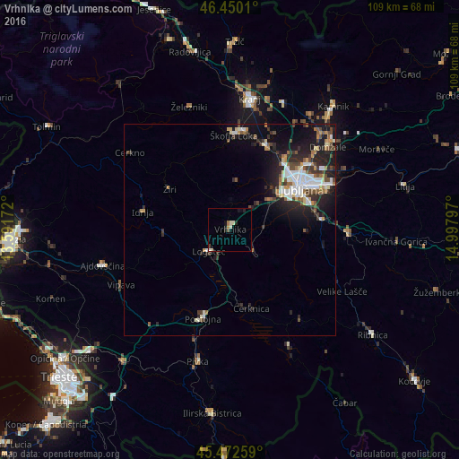
Analysis of Vrhnika night lights 2016
Square area 10x10 km:
 0.15%
0.15%90-99
1.79%80-89
0.45%70-79
0.6%60-69
0.6%50-59
0%40-49
0.74%30-39
0.45%20-29
1.79%10-19
1.79%0-9
91.67%Square area 50x50 km:
1.22%90-99
1.42%80-89
0.6%70-79
0.55%60-69
0.65%50-59
0.86%40-49
1.01%30-39
1.15%20-29
2.62%10-19
4.73%0-9
85.19%Clear (daylight) street map image can be seen on geolist.org.
Map coordinates:
46° 27' 0.4" North, 13° 35' 30.2" East
45° 57' 48.6" North, 14° 17' 41.4" East
45° 28' 21.3" North, 14° 59' 52.7" East
Some cities around Vrhnika sort by population:
• Logatec
7.6 km =4.7 mi,  224°
224°
• Žiri
16.9 km =10.5 mi,  301°
301°
• Brezovica pri Ljubljani
11.2 km =7 mi,  46°
46°
• Ig
18.1 km =11.2 mi,  91°
91°
• Borovnica
7.5 km =4.7 mi,  135°
135°
• Log pri Brezovici
8.1 km =5 mi,  43°
43°
• Horjul
6.7 km =4.2 mi,  2°
2°
• Dobrova
11.8 km =7.3 mi, 39°
3187214 (p: 8,413)
Sources (retrieved 2019-11-25):
» Earth at Night: Flat Maps 2012, 2016