Ig night lights from space
Night Light of Ig from space (Slovenia) Src. Average luminocity for 10x10km area is 6.2589% and for 50x50km: 7.3833%.
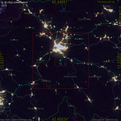
Analysis of Ig night lights 2016
Square area 10x10 km:
 0.45%
0.45%90-99
0.15%80-89
0.3%70-79
0.3%60-69
0.15%50-59
0.74%40-49
1.04%30-39
0.45%20-29
1.49%10-19
16.82%0-9
78.13%Square area 50x50 km:
1.25%90-99
1.48%80-89
0.64%70-79
0.55%60-69
0.66%50-59
0.88%40-49
1.16%30-39
1.1%20-29
2.67%10-19
5.12%0-9
84.49%Clear (daylight) street map image can be seen on geolist.org.
Map coordinates:
46° 26' 48.9" North, 13° 49' 32.8" East
45° 57' 37" North, 14° 31' 44" East
45° 28' 9.6" North, 15° 13' 55.3" East
Some cities around Ig sort by population:
• Ljubljana
10.3 km =6.4 mi,  349°
349°
• Grosuplje
10.1 km =6.3 mi,  92°
92°
• Brezovica pri Ljubljani
12.8 km =8 mi,  309°
309°
• Škofljica
4.5 km =2.8 mi,  55°
55°
• Borovnica
13.7 km =8.5 mi,  248°
248°
• Log pri Brezovici
14 km =8.7 mi,  296°
296°
• Dobrova
14.2 km =8.8 mi, 311°
• Dol pri Ljubljani
15.3 km =9.5 mi,  21°
21°
3199162 (p: 2,262)
Sources (retrieved 2019-11-25):
» Earth at Night: Flat Maps 2012, 2016