Žiri night lights from space
Night Light of Žiri from space (Slovenia) Src. Average luminocity for 10x10km area is 0.4489% and for 50x50km: 2.6526%.
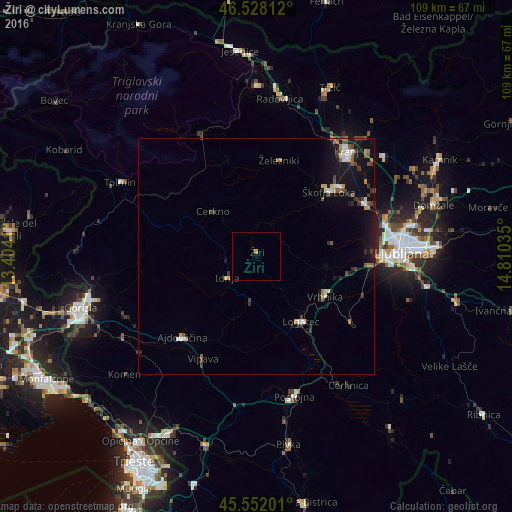
Analysis of Žiri night lights 2016
Square area 10x10 km:
 0%
0%90-99
0%80-89
0%70-79
0%60-69
0.57%50-59
0%40-49
0%30-39
0%20-29
0%10-19
0%0-9
99.43%Square area 50x50 km:
0.26%90-99
0.33%80-89
0.19%70-79
0.28%60-69
0.4%50-59
0.37%40-49
0.37%30-39
0.58%20-29
0.46%10-19
2.77%0-9
93.99%Clear (daylight) street map image can be seen on geolist.org.
Map coordinates:
46° 31' 41.2" North, 13° 24' 14.8" East
46° 2' 32" North, 14° 6' 26" East
45° 33' 7.2" North, 14° 48' 37.3" East
Some cities around Žiri sort by population:
• Škofja Loka
20.6 km =12.8 mi,  48°
48°
• Logatec
16.9 km =10.5 mi,  147°
147°
• Vrhnika
16.9 km =10.5 mi,  121°
121°
• Idrija
7.4 km =4.6 mi,  233°
233°
• Log pri Brezovici
20.2 km =12.6 mi,  98°
98°
• Cerkno
13.4 km =8.3 mi,  313°
313°
• Horjul
15 km =9.3 mi, 97°
• Gorenja Vas
7.9 km =4.9 mi,  23°
23°
3186450 (p: 3,588)
Sources (retrieved 2019-11-25):
» Earth at Night: Flat Maps 2012, 2016