Mokronog night lights from space
Night Light of Mokronog (Mokronog-Trebelno) from space (Slovenia) Src. Average luminocity for 10x10km area is 0.689% and for 50x50km: 1.8169%.
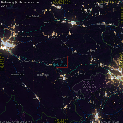
Analysis of Mokronog night lights 2016
Square area 10x10 km:
 0%
0%90-99
0%80-89
0%70-79
0%60-69
0%50-59
0.6%40-49
0%30-39
0.6%20-29
0%10-19
0.6%0-9
98.21%Square area 50x50 km:
0.16%90-99
0.19%80-89
0.11%70-79
0.25%60-69
0.37%50-59
0.33%40-49
0.39%30-39
0.33%20-29
0.39%10-19
0.39%0-9
97.09%Clear (daylight) street map image can be seen on geolist.org.
Map coordinates:
46° 25' 15.7" North, 14° 26' 15.8" East
45° 56' 3" North, 15° 8' 27" East
45° 26' 34.8" North, 15° 50' 38.3" East
Some cities around Mokronog sort by population:
• Novo Mesto
14.6 km =9.1 mi,  171°
171°
• Trebnje
9.8 km =6.1 mi,  250°
250°
• Radeče
15.3 km =9.5 mi,  12°
12°
• Mirna
6.5 km =4 mi,  291°
291°
• Mirna Peč
9.3 km =5.8 mi,  208°
208°
• Šentrupert
6 km =3.7 mi,  324°
324°
• Šmarjeta
10.2 km =6.3 mi,  123°
123°
• Škocjan
12 km =7.5 mi,  104°
104°
3194904 (p: 637)
Sources (retrieved 2019-11-25):
» Earth at Night: Flat Maps 2012, 2016