Selnica ob Dravi night lights from space
Night Light of Selnica ob Dravi from space (Slovenia) Src. Average luminocity for 10x10km area is 6.1307% and for 50x50km: 5.665%.
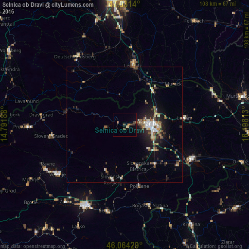
Analysis of Selnica ob Dravi night lights 2016
Square area 10x10 km:
 0%
0%90-99
0%80-89
1.14%70-79
1.14%60-69
1.14%50-59
0.99%40-49
0.71%30-39
2.84%20-29
0%10-19
0.28%0-9
91.76%Square area 50x50 km:
0.6%90-99
0.91%80-89
0.39%70-79
0.46%60-69
0.8%50-59
0.94%40-49
1.11%30-39
0.96%20-29
1.77%10-19
3.19%0-9
88.87%Clear (daylight) street map image can be seen on geolist.org.
Map coordinates:
47° 1' 53" North, 14° 47' 30.8" East
46° 33' 0" North, 15° 29' 42" East
46° 3' 51.4" North, 16° 11' 53.3" East
Some cities around Selnica ob Dravi sort by population:
• Maribor
11.6 km =7.2 mi,  87°
87°
• Ruše
2 km =1.2 mi,  126°
126°
• Miklavž na Dravskem Polju
16.2 km =10.1 mi,  107°
107°
• Spodnje Hoče
13.1 km =8.1 mi,  115°
115°
• Lovrenc na Pohorju
7.9 km =4.9 mi,  262°
262°
• Pesnica pri Mariboru
15.3 km =9.5 mi,  65°
65°
• Zgornja Kungota
13.5 km =8.4 mi,  42°
42°
• Podvelka
13.2 km =8.2 mi,  288°
288°
3339128 (p: 1,297)
Sources (retrieved 2019-11-25):
» Earth at Night: Flat Maps 2012, 2016