Zgornja Kungota night lights from space
Night Light of Zgornja Kungota (Kungota) from space (Slovenia) Src. Average luminocity for 10x10km area is 10.3239% and for 50x50km: 5.6639%.
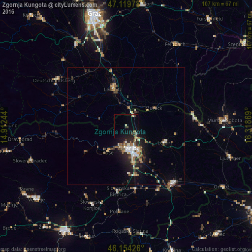
Analysis of Zgornja Kungota night lights 2016
Square area 10x10 km:
 0.43%
0.43%90-99
0.99%80-89
0.99%70-79
0.99%60-69
1.28%50-59
1.42%40-49
1.42%30-39
1.14%20-29
1.99%10-19
12.93%0-9
76.42%Square area 50x50 km:
0.66%90-99
0.86%80-89
0.46%70-79
0.49%60-69
0.79%50-59
0.9%40-49
0.97%30-39
0.9%20-29
1.83%10-19
3.22%0-9
88.92%Clear (daylight) street map image can be seen on geolist.org.
Map coordinates:
47° 7' 11.2" North, 14° 54' 44.8" East
46° 38' 21" North, 15° 36' 56" East
46° 9' 15.3" North, 16° 19' 7.3" East
Some cities around Zgornja Kungota sort by population:
• Maribor
9.7 km =6 mi,  165°
165°
• Ruše
13.5 km =8.4 mi,  214°
214°
• Miklavž na Dravskem Polju
16.1 km =10 mi,  157°
157°
• Spodnje Hoče
15.7 km =9.8 mi, 170°
• Šentilj v Slov. Goricah
5.3 km =3.3 mi,  27°
27°
• Selnica ob Dravi
13.5 km =8.4 mi,  222°
222°
• Pesnica pri Mariboru
5.9 km =3.7 mi,  127°
127°
• Jurovski Dol
13.4 km =8.3 mi,  105°
105°
3186538 (p: 535)
Sources (retrieved 2019-11-25):
» Earth at Night: Flat Maps 2012, 2016