Podvelka night lights from space
Night Light of Podvelka from space (Slovenia) Src. Average luminocity for 10x10km area is 0.9517% and for 50x50km: 4.2625%.
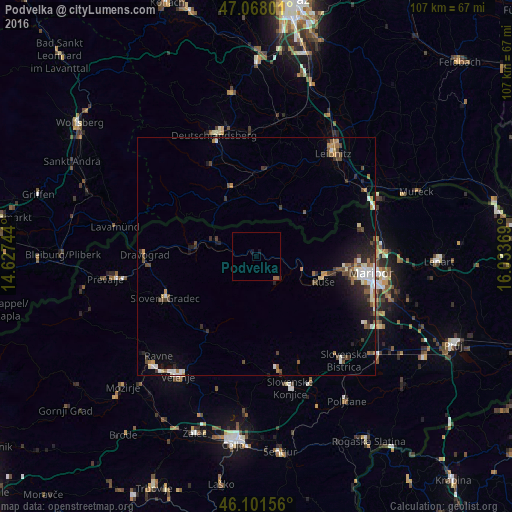
Analysis of Podvelka night lights 2016
Square area 10x10 km:
 0%
0%90-99
0%80-89
0%70-79
0%60-69
0.57%50-59
0.57%40-49
0%30-39
0%20-29
0.28%10-19
1.14%0-9
97.44%Square area 50x50 km:
0.54%90-99
0.73%80-89
0.3%70-79
0.42%60-69
0.5%50-59
0.56%40-49
0.97%30-39
0.68%20-29
1.07%10-19
1.95%0-9
92.26%Clear (daylight) street map image can be seen on geolist.org.
Map coordinates:
47° 4' 4.8" North, 14° 37' 38.8" East
46° 35' 13" North, 15° 19' 50" East
46° 6' 5.6" North, 16° 2' 1.3" East
Some cities around Podvelka sort by population:
• Ruše
15.1 km =9.4 mi,  110°
110°
• Radlje ob Dravi
8.5 km =5.3 mi,  290°
290°
• Muta
12.9 km =8 mi,  282°
282°
• Lovrenc na Pohorju
7 km =4.3 mi,  137°
137°
• Mislinja
19 km =11.8 mi,  211°
211°
• Vuzenica
12.5 km =7.8 mi,  274°
274°
• Selnica ob Dravi
13.2 km =8.2 mi, 108°
• Ribnica na Pohorju
7.3 km =4.5 mi,  217°
217°
3192899 (p: 343)
Sources (retrieved 2019-11-25):
» Earth at Night: Flat Maps 2012, 2016