Lovrenc na Pohorju night lights from space
Night Light of Lovrenc na Pohorju from space (Slovenia) Src. Average luminocity for 10x10km area is 1.4602% and for 50x50km: 5.6019%.
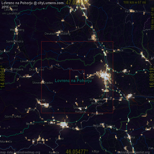
Analysis of Lovrenc na Pohorju night lights 2016
Square area 10x10 km:
 0%
0%90-99
0%80-89
0%70-79
0%60-69
1.14%50-59
0.57%40-49
0%30-39
0%20-29
1.14%10-19
0%0-9
97.16%Square area 50x50 km:
0.66%90-99
1.04%80-89
0.43%70-79
0.46%60-69
0.72%50-59
0.8%40-49
1%30-39
0.86%20-29
1.69%10-19
3.16%0-9
89.18%Clear (daylight) street map image can be seen on geolist.org.
Map coordinates:
47° 1' 19.3" North, 14° 41' 23.8" East
46° 32' 26" North, 15° 23' 35" East
46° 3' 17.2" North, 16° 5' 46.3" East
Some cities around Lovrenc na Pohorju sort by population:
• Ruše
9.4 km =5.8 mi,  90°
90°
• Zreče
17.6 km =10.9 mi,  183°
183°
• Radlje ob Dravi
15.1 km =9.4 mi,  302°
302°
• Vuzenica
18.3 km =11.4 mi,  289°
289°
• Oplotnica
17.5 km =10.9 mi,  166°
166°
• Selnica ob Dravi
7.9 km =4.9 mi,  82°
82°
• Ribnica na Pohorju
9.2 km =5.7 mi,  266°
266°
• Podvelka
7 km =4.3 mi,  317°
317°
3196165 (p: 1,977)
Sources (retrieved 2019-11-25):
» Earth at Night: Flat Maps 2012, 2016