Kozina night lights from space
Night Light of Kozina (Hrpelje-Kozina) from space (Slovenia) Src. Average luminocity for 10x10km area is 5.2439% and for 50x50km: 7.8357%.
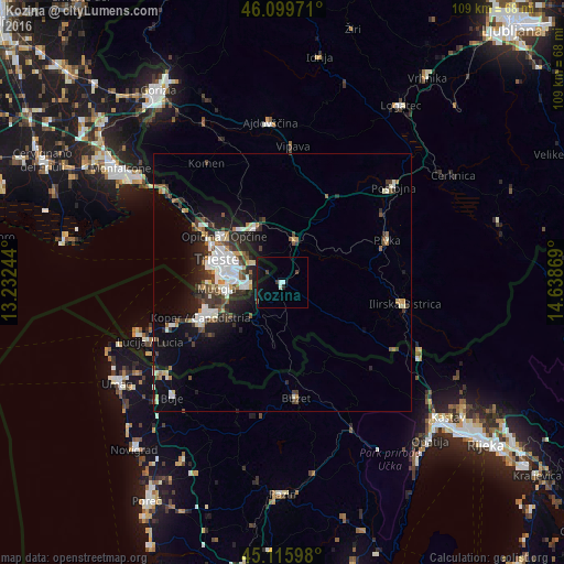
Analysis of Kozina night lights 2016
Square area 10x10 km:
 0.76%
0.76%90-99
1.06%80-89
0%70-79
0%60-69
0%50-59
0%40-49
1.67%30-39
0.45%20-29
0.61%10-19
6.52%0-9
88.94%Square area 50x50 km:
1.29%90-99
1.81%80-89
0.54%70-79
0.57%60-69
0.63%50-59
0.9%40-49
1.17%30-39
1.56%20-29
2.19%10-19
4.77%0-9
84.57%Clear (daylight) street map image can be seen on geolist.org.
Map coordinates:
46° 5' 59" North, 13° 13' 56.8" East
45° 36' 36" North, 13° 56' 8" East
45° 6' 57.5" North, 14° 38' 19.3" East
Some cities around Kozina sort by population:
• Trieste, IT
13.1 km =8.1 mi,  289°
289°
• Koper
17.5 km =10.9 mi,  246°
246°
• Muggia, IT
13.1 km =8.1 mi,  267°
267°
• Villa Opicina, IT
14.3 km =8.9 mi,  307°
307°
• Sežana
12 km =7.5 mi,  336°
336°
• Ankaran
15.9 km =9.9 mi,  257°
257°
• Pivka
21.8 km =13.5 mi,  68°
68°
• Divača
8.7 km =5.4 mi,  17°
17°
3197462 (p: 544)
Sources (retrieved 2019-11-25):
» Earth at Night: Flat Maps 2012, 2016