Celje night lights from space
Night Light of Celje from space (Slovenia) Src. Average luminocity for 10x10km area is 25.3973% and for 50x50km: 3.9721%.
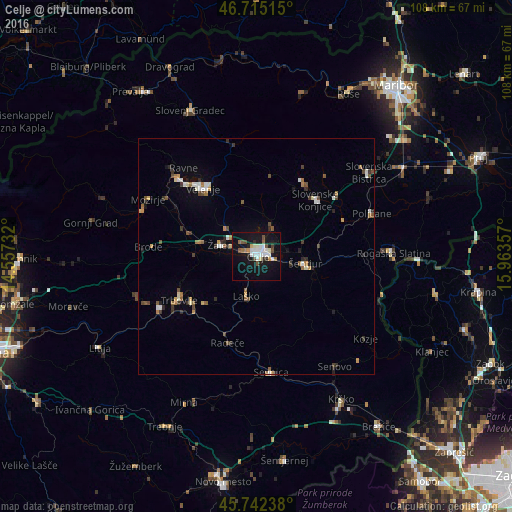
Analysis of Celje night lights 2016
Square area 10x10 km:
100  5.06%
5.06%
90-99 6.4%
80-89 1.49%
70-79 1.34%
60-69 1.34%
50-59 3.27%
40-49 3.13%
30-39 1.19%
20-29 2.38%
10-19 33.78%
0-9 40.63%
5.06%90-99
6.4%80-89
1.49%70-79
1.34%60-69
1.34%50-59
3.27%40-49
3.13%30-39
1.19%20-29
2.38%10-19
33.78%0-9
40.63%Square area 50x50 km:
100 0.43%
90-99 0.7%
80-89 0.29%
70-79 0.36%
60-69 0.49%
50-59 0.64%
40-49 0.61%
30-39 0.55%
20-29 0.65%
10-19 1.91%
0-9 93.38%
0.43%90-99
0.7%80-89
0.29%70-79
0.36%60-69
0.49%50-59
0.64%40-49
0.61%30-39
0.55%20-29
0.65%10-19
1.91%0-9
93.38%Clear (daylight) street map image can be seen on geolist.org.
Map coordinates:
46° 42' 54.5" North, 14° 33' 26.4" East
46° 13' 51.3" North, 15° 15' 37.6" East
45° 44' 32.6" North, 15° 57' 48.9" East
Some cities around Celje sort by population:
• Žalec
7.7 km =4.8 mi,  287°
287°
• Šentjur
10.7 km =6.6 mi,  98°
98°
• Laško
8.7 km =5.4 mi,  192°
192°
• Vojnik
7.7 km =4.8 mi,  25°
25°
• Štore
4.3 km =2.7 mi,  105°
105°
• Prebold
12.9 km =8 mi,  272°
272°
• Dobrna
12.1 km =7.5 mi,  347°
347°
• Dobje pri Planini
14.6 km =9.1 mi,  135°
135°
3202781 (p: 37,520)
Sources (retrieved 2019-11-25):
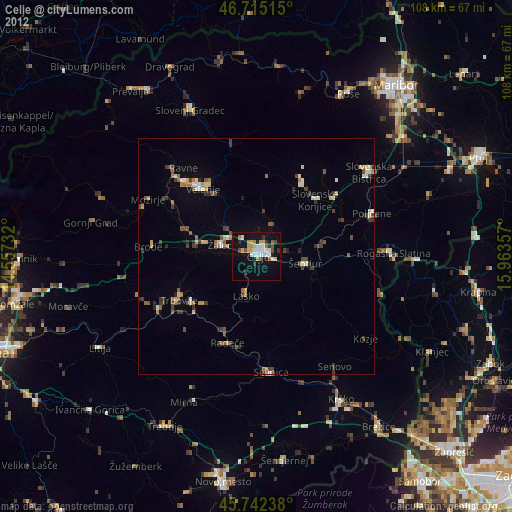
» Earth at Night: Flat Maps 2012, 2016