Woodlands night lights from space
Night Light of Woodlands from space (Singapore) Src. Average luminocity for 10x10km area is 95.7987% and for 50x50km: 71.9937%.
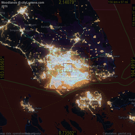
Analysis of Woodlands night lights 2016
Square area 10x10 km:
 47.4%
47.4%90-99
34.63%80-89
11.04%70-79
6.93%60-69
0%50-59
0%40-49
0%30-39
0%20-29
0%10-19
0%0-9
0%Square area 50x50 km:
27.3%90-99
16.19%80-89
5.71%70-79
12.84%60-69
10.25%50-59
5.4%40-49
4.63%30-39
3.37%20-29
3.31%10-19
4.98%0-9
6.01%Clear (daylight) street map image can be seen on geolist.org.
Map coordinates:
2° 8' 26.8" North, 103° 5' 8.3" East
1° 26' 16.8" North, 103° 47' 19.6" East
0° 44' 6.1" North, 104° 29' 30.8" East
Some cities around Woodlands sort by population:
• Singapore
17.8 km =11.1 mi,  157°
157°
• Johor Bahru, MY
4.6 km =2.9 mi,  311°
311°
• Skudai, MY
18.3 km =11.4 mi, 307°
• Kampung Pasir Gudang Baru, MY
10.6 km =6.6 mi,  68°
68°
• Ulu Tiram, MY
18.3 km =11.4 mi,  9°
9°
• Taman Senai, MY
24.4 km =15.2 mi,  317°
317°
• Kulai, MY
31.8 km =19.8 mi, 319°
• Pekan Nenas, MY
31.6 km =19.6 mi,  284°
284°
1882316 (p: 252,530)
Sources (retrieved 2019-11-25):
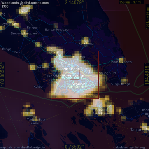
» NASA, Earths city lights 1995
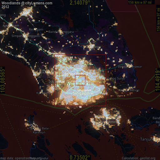
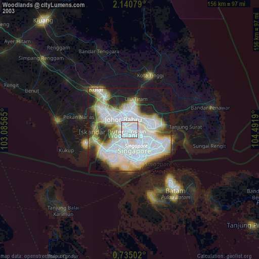
» NASA city lights 2003
» Earth at Night: Flat Maps 2012, 2016