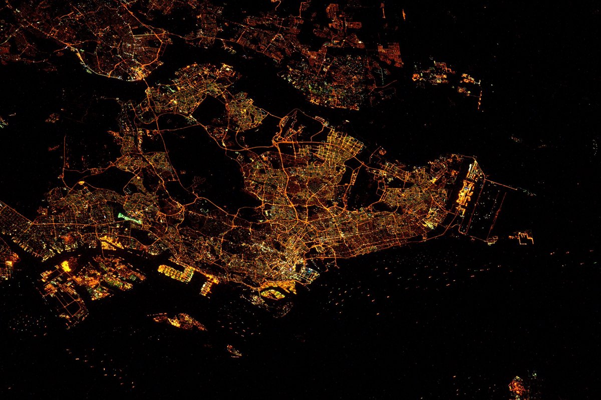
Singapore night lights from space
Night Light of Singapore from space (Singapore) Src. Average luminocity for 10x10km area is 94.5498% and for 50x50km: 59.3598%.
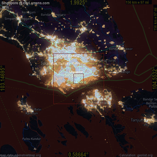
Analysis of Singapore night lights 2016
Square area 10x10 km:
 62.12%
90-99
18.61%80-89
3.46%70-79
10.61%60-69
4.98%50-59
0.22%40-49
0%30-39
0%20-29
0%10-19
0%0-9
0%Square area 50x50 km:
22.24%90-99
12.83%80-89
4.72%70-79
9.88%60-69
6.73%50-59
4.53%40-49
4.84%30-39
4.02%20-29
4.57%10-19
9.62%0-9
16.02%Clear (daylight) street map image can be seen on geolist.org.
Map coordinates:
1° 59' 33" North, 103° 8' 49" East
1° 17' 22.8" North, 103° 51' 0.3" East
0° 35' 11.9" North, 104° 33' 11.5" East
Fantastic image of Singapore from space taken by astronauts [src2], but I don't have information about it's orientation, scale or angle. If necessary, it was rotated manually, so North points approximately to upper direction. Click to zoom in:
Some cities around Singapore sort by population:
• Batam, ID
24.9 km =15.5 mi,  128°
128°
• Johor Bahru, MY
22.1 km =13.7 mi,  332°
332°
• Woodlands
17.8 km =11.1 mi,  337°
337°
• Skudai, MY
34.9 km =21.7 mi,  322°
322°
• Kampung Pasir Gudang Baru, MY
20.6 km =12.8 mi,  8°
8°
• Ulu Tiram, MY
34.7 km =21.6 mi,  353°
353°
• Taman Senai, MY
41.6 km =25.8 mi, 326°
• Pekan Nenas, MY
44.7 km =27.8 mi,  303°
303°
1880252 (p: 3,547,809)
Sources (retrieved 2019-11-25):
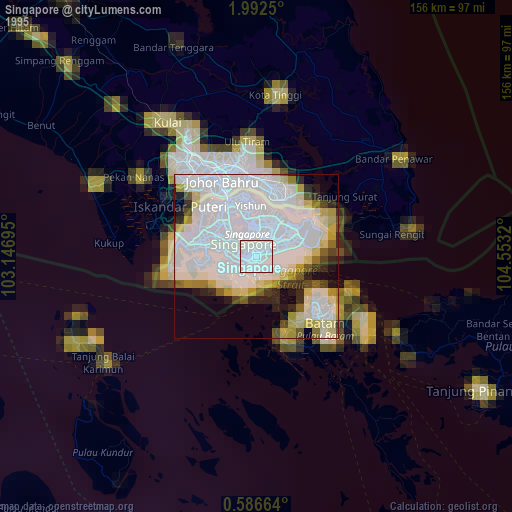
» NASA, Earths city lights 1995
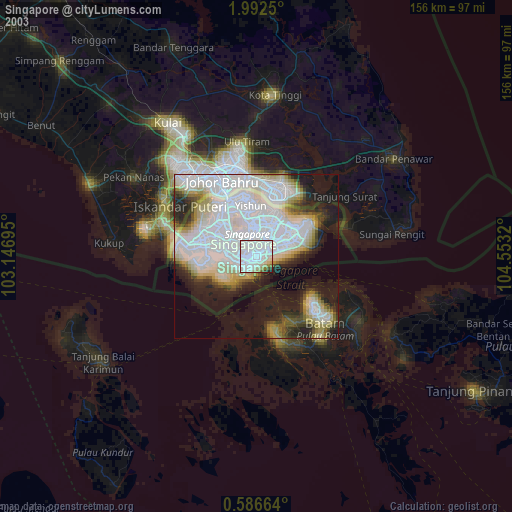
» NASA city lights 2003
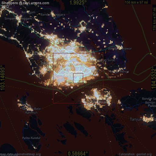
» Earth at Night: Flat Maps 2012, 2016
Src.2: Tim Kopra, Twitter/@astro_tim, 2016-03-19