Sigtuna night lights from space
Night Light of Sigtuna (Stockholm) from space (Sweden) Src. Average luminocity for 10x10km area is 15.2914% and for 50x50km: 17.0272%.
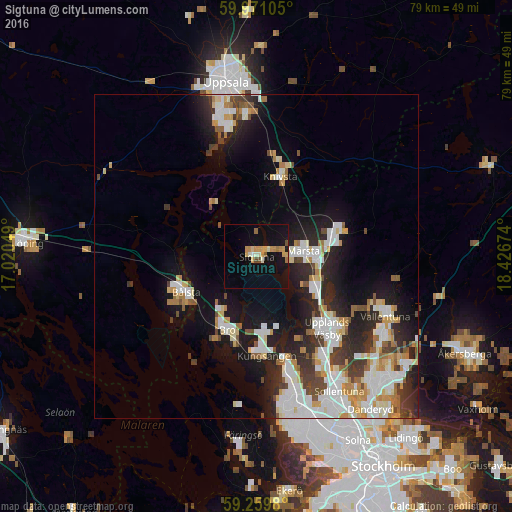
Analysis of Sigtuna night lights 2016
Square area 10x10 km:
 0.34%
0.34%90-99
2.38%80-89
1.7%70-79
5.44%60-69
1.13%50-59
1.02%40-49
1.13%30-39
0%20-29
0%10-19
18.03%0-9
68.82%Square area 50x50 km:
3.69%90-99
4.27%80-89
1.56%70-79
1.98%60-69
1.56%50-59
1.22%40-49
1.62%30-39
1.85%20-29
4.64%10-19
9.44%0-9
68.16%Clear (daylight) street map image can be seen on geolist.org.
Map coordinates:
59° 58' 15.8" North, 17° 1' 13.8" East
59° 37' 2.3" North, 17° 43' 25" East
59° 15' 35.3" North, 18° 25' 36.3" East
Some cities around Sigtuna sort by population:
• Upplands Väsby
15.3 km =9.5 mi,  136°
136°
• Vallentuna
22 km =13.7 mi,  114°
114°
• Märsta
7.4 km =4.6 mi,  86°
86°
• Bålsta
12.4 km =7.7 mi,  243°
243°
• Kungsängen
15.5 km =9.6 mi,  174°
174°
• Sävja
22.4 km =13.9 mi,  356°
356°
• Bro
12.3 km =7.6 mi,  204°
204°
• Knivsta
12.6 km =7.8 mi,  16°
16°
2679302 (p: 9,074)
Sources (retrieved 2019-11-25):
» Earth at Night: Flat Maps 2012, 2016