Bro night lights from space
Night Light of Bro (Stockholm) from space (Sweden) Src. Average luminocity for 10x10km area is 24.305% and for 50x50km: 20.1245%.
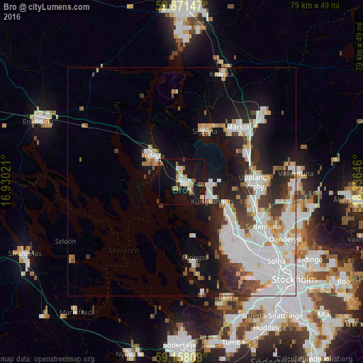
Analysis of Bro night lights 2016
Square area 10x10 km:
 2.61%
2.61%90-99
4.08%80-89
3.63%70-79
2.72%60-69
2.49%50-59
3.06%40-49
2.72%30-39
0%20-29
1.59%10-19
44.44%0-9
32.65%Square area 50x50 km:
6.32%90-99
5.32%80-89
1.45%70-79
1.86%60-69
1.32%50-59
1.21%40-49
1.66%30-39
1.76%20-29
4.22%10-19
8.83%0-9
66.04%Clear (daylight) street map image can be seen on geolist.org.
Map coordinates:
59° 52' 17.3" North, 16° 55' 48.8" East
59° 31' 0" North, 17° 37' 60" East
59° 9' 29.1" North, 18° 20' 11.3" East
Some cities around Bro sort by population:
• Upplands Väsby
15.7 km =9.8 mi,  89°
89°
• Märsta
17.1 km =10.6 mi,  46°
46°
• Jakobsberg
15.5 km =9.6 mi,  132°
132°
• Tensta
20.4 km =12.7 mi, 132°
• Bålsta
8.2 km =5.1 mi,  313°
313°
• Kungsängen
7.8 km =4.8 mi,  123°
123°
• Sigtuna
12.3 km =7.6 mi,  24°
24°
• Akalla
19.5 km =12.1 mi, 125°
2719245 (p: 8,266)
Sources (retrieved 2019-11-25):
» Earth at Night: Flat Maps 2012, 2016